Area Overview for GU24 8TA
Photos of GU24 8TA
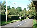
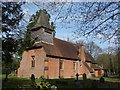
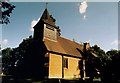
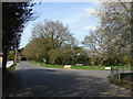
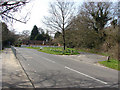
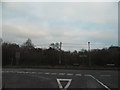
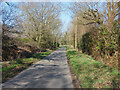
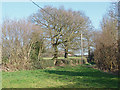
34 photos from this area
Area Information
Key information about the GU24 8TA including its size, population, and administrative classification.
- Area Type
- Postcode
- Area Size
- 17.2 hectares
- Population
- 1235
- Population Density
- 77 people/km²
House Prices in GU24 8TA
9
Properties
£1,080,000
Average Sold Price
£860,000
Lowest Price
£1,675,000
Highest Price
Showing 9 properties
| Address | Type | Beds | Baths | Last Sale Price | Last Sale Date | |
|---|---|---|---|---|---|---|
| Fox Hollow, Sparrow Row, Chobham, Woking, GU24 8TA | Bungalow | 3 | 1 | £1,000,000 | May 2022 | |
| Granny Beetles Cottage, Sparrow Row, Chobham, Woking, GU24 8TA | Detached | - | 1 | £860,000 | Dec 2018 | |
| Sparrow Cottage, Sparrow Row, Chobham, Woking, GU24 8TA | Cottage | 3 | 3 | £900,000 | Oct 2018 | |
| Sparrow Hill House, Sparrow Row, Chobham, Woking, GU24 8TA | Detached | 5 | 3 | £1,675,000 | Aug 2015 | |
| One Tree Hill, Sparrow Row, Chobham, Woking, GU24 8TA | house | - | - | £965,000 | Oct 2005 | |
| Tennis 38M From Lavender, Sparrow Row 36M From Sparrow Row, Sparrow Row, Chobham, Woking, GU24 8TA | Leisure | - | - | - | - | |
| Paddock Adjacent To Woodside, Sparrow Row, Chobham, Woking, GU24 8TA | Farm | - | - | - | - | |
| Lavender, Sparrow Row, Chobham, Woking, GU24 8TA | Bungalow | 4 | 3 | - | - | |
| Woodside, Sparrow Row, Chobham, Woking, GU24 8TA | house | - | - | - | - |
Energy Efficiency in GU24 8TA
Amenities
Schools
| Rank | School | Type | Entry gender | Ages |
|---|
Explore more schools in this area
Go to Schools tabDemographics
Household Size
Two person
most common
Accommodation Type
Houses
most common
Tenure
81
majority
Ethnic Group
White
most common
Religion
N/A
most common
Household Composition
N/A
most common
Age
47
median
Adults (30-64 years)
most common
Household Deprivation
N/A
with no deprivation
NS-SEC
47
in Lower managerial occupations
Explore more demographic insights in this area
Go to Demographics tabPlanning
Planning Constraints
- Flood RiskPremium
- Ramsar Wetland SitesPremium
- Area of Outstanding Natural BeautyPremium
- Protected Nature ReservePremium
- Protected WoodlandPremium