Area Overview for GU23 7JW
Photos of GU23 7JW
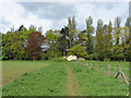
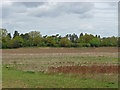
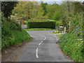
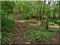
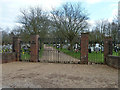
21 photos from this area
Area Information
Key information about the GU23 7JW including its size, population, and administrative classification.
- Area Type
- Postcode
- Area Size
- 21.2 hectares
- Population
- 1397
- Population Density
- 407 people/km²
House Prices in GU23 7JW
9
Properties
£1,428,000
Average Sold Price
£1,000,000
Lowest Price
£2,030,000
Highest Price
Showing 9 properties
| Address | Type | Beds | Baths | Last Sale Price | Last Sale Date | |
|---|---|---|---|---|---|---|
| Lansdown Lodge, Woodhill, Send, GU23 7JW | Semi-detached | 5 | 3 | £1,200,000 | Aug 2022 | |
| Cunningham House, Woodhill, Send, GU23 7JW | house | - | - | £1,235,000 | Dec 2016 | |
| Sendhurst Grange, Woodhill, Send, GU23 7JW | Detached | 4 | 3 | £2,030,000 | Dec 2015 | |
| Oakdene, Woodhill, Send, GU23 7JW | Detached | 4 | 2 | £1,675,000 | Mar 2008 | |
| Old Timbers, Woodhill, Send, GU23 7JW | Equestrian | 8 | 4 | £1,000,000 | Aug 2003 | |
| Flat, Sendhurst Lodge, Woodhill, Send, GU23 7JW | Flat | - | - | - | - | |
| Tennis 51M From Old Timbers, Woodhill 87M From Unnamed Road, Woodhill, Send, GU23 7JW | Leisure | - | - | - | - | |
| Willow Farm, Woodhill, Send, GU23 7JW | house | - | - | - | - | |
| Sendhurst Lodge, Woodhill, Send, GU23 7JW | house | - | - | - | - |
Energy Efficiency in GU23 7JW
Amenities
Schools
| Rank | School | Type | Entry gender | Ages |
|---|
Explore more schools in this area
Go to Schools tabDemographics
Household Size
Family (3-5 people)
most common
Accommodation Type
Houses
most common
Tenure
91
majority
Ethnic Group
White
most common
Religion
N/A
most common
Household Composition
N/A
most common
Age
47
median
Adults (30-64 years)
most common
Household Deprivation
N/A
with no deprivation
NS-SEC
50
in Lower managerial occupations
Explore more demographic insights in this area
Go to Demographics tabPlanning
Planning Constraints
- Flood RiskPremium
- Ramsar Wetland SitesPremium
- Area of Outstanding Natural BeautyPremium
- Protected Nature ReservePremium
- Protected WoodlandPremium