Area Overview for GU23 7AD
Photos of GU23 7AD

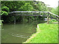
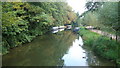
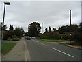
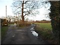
48 photos from this area
Area Information
Key information about the GU23 7AD including its size, population, and administrative classification.
- Area Type
- Postcode
- Area Size
- 58.3 hectares
- Population
- 1695
- Population Density
- 575 people/km²
House Prices in GU23 7AD
20
Properties
£646,545
Average Sold Price
£152,000
Lowest Price
£2,350,000
Highest Price
Showing 20 properties
| Address | Type | Beds | Baths | Last Sale Price | Last Sale Date | |
|---|---|---|---|---|---|---|
| Ashburton House, Broadmead Road, Send, GU23 7AD | Detached | 8 | 3 | £2,350,000 | Feb 2023 | |
| Kestrel, Broadmeads, Send, GU23 7AD | Bungalow | 3 | 2 | £780,000 | Mar 2022 | |
| Ashburton Lodge, Broadmead Road, Send, GU23 7AD | house | - | - | £665,000 | Nov 2021 | |
| Kingsley, Broadmeads, Send, GU23 7AD | Bungalow | 3 | 1 | £540,000 | Oct 2020 | |
| Harlequin, Broadmeads, Send, GU23 7AD | Bungalow | 2 | 1 | £475,000 | Feb 2018 | |
| The Cottage, Broadmead Road, Send, GU23 7AD | Detached | 3 | - | £675,000 | Oct 2015 | |
| Silvermere, Broadmeads, Send, GU23 7AD | Bungalow | 3 | 1 | £407,500 | Apr 2014 | |
| Foxes Wey, Broadmead Road, Send, GU23 7AD | Bungalow | 2 | - | £360,000 | Feb 2013 | |
| Hobbits Way, Broadmeads, Send, GU23 7AD | Detached | - | - | £447,500 | Aug 2007 | |
| Rowan Cottage, Broadmead Road, Send, GU23 7AD | Detached | - | - | £260,000 | May 2003 |
Page 1 of 2
Energy Efficiency in GU23 7AD
Amenities
Schools
| Rank | School | Type | Entry gender | Ages |
|---|
Explore more schools in this area
Go to Schools tabDemographics
Household Size
Two person
most common
Accommodation Type
Houses
most common
Tenure
69
majority
Ethnic Group
White
most common
Religion
N/A
most common
Household Composition
N/A
most common
Age
47
median
Adults (30-64 years)
most common
Household Deprivation
N/A
with no deprivation
NS-SEC
43
in Lower managerial occupations
Explore more demographic insights in this area
Go to Demographics tabPlanning
Planning Constraints
- Flood RiskPremium
- Ramsar Wetland SitesPremium
- Area of Outstanding Natural BeautyPremium
- Protected Nature ReservePremium
- Protected WoodlandPremium