Area Overview for GU22 9PX
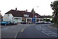
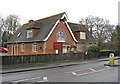
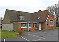
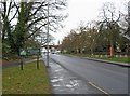
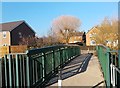
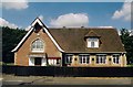
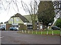
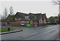
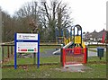
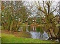
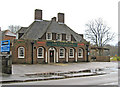
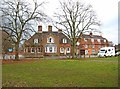
Photos of GU22 9PX
Area Information
GU22 9PX is a compact residential area in England, covering just 1.1 hectares and home to 1,217 residents. Its high population density of 113,595 people per square kilometre suggests a tightly knit community, where proximity to amenities and services is a defining feature. The area is characterised by a focus on homeownership, with 78% of residents owning their homes, and a predominance of single-family houses. This small postcode cluster is likely to appeal to those seeking a stable, established environment with access to nearby infrastructure. Daily life here is shaped by the local schools, retail options, and transport links, which are all within practical reach. While the area’s size is limited, its strategic location near Woking and Fairoaks Airport offers connectivity to broader regional networks. For buyers, the challenge lies in the scarcity of properties, but the compact nature ensures that essential services are never far away.
- Area Type
- Postcode
- Area Size
- 1.1 hectares
- Population
- 1217
- Population Density
- 3866 people/km²
GU22 9PX is primarily an owner-occupied area, with 78% of homes owned by residents rather than rented. The accommodation type is predominantly houses, which is unusual for a small postcode cluster and may indicate a focus on family homes or long-term residency. This suggests a market where properties are likely to be held for extended periods, reducing turnover. For buyers, the limited size of the area means competition for available homes could be intense, particularly given the proximity to amenities and transport. The dominance of houses over flats or apartments may also mean that properties are larger, appealing to those prioritising space. However, the small footprint of the postcode means buyers must consider nearby areas for additional options.
House Prices in GU22 9PX
Showing 16 properties
| Address | Type | Beds | Baths | Last Sale Price | Last Sale Date | |
|---|---|---|---|---|---|---|
| 69 Westfield Road, Westfield, Woking, GU22 9PX | Detached | 4 | 1 | £725,000 | Feb 2025 | |
| 79 Westfield Road, Westfield, Woking, GU22 9PX | Semi-detached | 4 | 2 | £552,500 | Aug 2020 | |
| Westways, 79A Westfield Road, Westfield, Woking, GU22 9PX | Detached | 4 | 3 | £567,500 | Aug 2018 | |
| 67 Westfield Road, Westfield, Woking, GU22 9PX | Detached | 3 | 1 | £670,000 | Jun 2018 | |
| 65 Westfield Road, Westfield, Woking, GU22 9PX | Detached | 4 | - | £710,500 | Nov 2016 | |
| 81 Westfield Road, Westfield, Woking, GU22 9PX | Detached | 3 | - | £445,000 | Mar 2012 | |
| 85 Westfield Road, Westfield, Woking, GU22 9PX | Semi-detached | 3 | - | £245,000 | Jun 2010 | |
| 77 Westfield Road, Westfield, Woking, GU22 9PX | Semi-detached | 3 | 1 | £295,000 | Jun 2009 | |
| 89 Westfield Road, Westfield, Woking, GU22 9PX | Detached | 4 | 2 | £455,000 | Aug 2008 | |
| 83 Westfield Road, Westfield, Woking, GU22 9PX | house | - | - | £295,000 | Sep 2005 |
Energy Efficiency in GU22 9PX
The lifestyle in GU22 9PX is shaped by its proximity to essential amenities. Retail options include Co-op Woking, Morrisons Daily, and Sainsburys Woking, all within practical reach, ensuring residents have access to daily shopping needs. The rail stations—Worplesdon, Brookwood, and Clandon—connect the area to broader networks, facilitating commuting or leisure travel. Fairoaks Airport adds to the convenience for those requiring air travel. While the data does not specify parks or leisure facilities, the presence of retail and transport hubs suggests a focus on practicality over expansive recreational spaces. The compact nature of the area means that amenities are clustered closely, reducing the need for long commutes and fostering a self-contained community feel.
Amenities
Schools
The area is served by two primary schools: Kingfield Primary School and Westfield First School. Both are primary institutions, with Kingfield Primary School holding a ‘good’ Ofsted rating. The presence of two primary schools within the area provides families with options for early education, though secondary schooling is not listed in the data. This suggests that parents may need to look beyond GU22 9PX for secondary education. The availability of primary schools is a key consideration for families, particularly given the area’s demographic skew towards adults aged 30–64, who may have children in primary education. The ‘good’ rating at Kingfield Primary School indicates a level of quality that could be a draw for prospective buyers.
| Rank | School | Type | Entry gender | Ages |
|---|
Explore more schools in this area
Go to Schools tabDemographics
The population of GU22 9PX skews towards adults aged 30–64, with a median age of 47. This suggests a community of established individuals, many of whom may be homeowners, as 78% of residents own their homes. The area is predominantly White, and the accommodation type is largely houses, indicating a mix of family homes and long-term residences. The high proportion of homeownership and the age profile suggest a stable, low-turnover environment. However, the data does not provide specific information on deprivation levels or income distribution, so it is unclear how economic factors influence quality of life. The absence of detailed diversity metrics means the community’s broader demographic composition remains partially unexplored.
Household Size
Accommodation Type
Tenure
Ethnic Group
Religion
Household Composition
Age
Household Deprivation
NS-SEC
Explore more demographic insights in this area
Go to Demographics tabPlanning
Planning Constraints
- Flood RiskPremium
- Ramsar Wetland SitesPremium
- Area of Outstanding Natural BeautyPremium
- Protected Nature ReservePremium
- Protected WoodlandPremium