Area Overview for GU22 9NJ
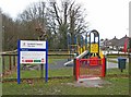
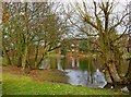
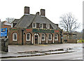
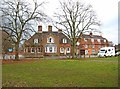
Photos of GU22 9NJ
Area Information
Living in GU22 9NJ means inhabiting a tightly knit residential cluster in England, where 1,217 people reside across 8,356 square metres. This small area has a remarkably high population density of 145,643 people per square kilometre, reflecting a compact, possibly multi-generational community. The postcode is characterised by its housing stock, with 78% of properties owned by residents rather than rented. Daily life here is shaped by proximity to amenities, with five retail outlets within practical reach, including major chains like Co-op Woking and Sainsburys. The area’s strategic location offers rail access to stations such as Worplesdon and Brookwood, linking residents to broader networks. Nearby Fairoaks Airport adds to its connectivity. While the population is predominantly White and skewed toward adults aged 30–64, the community’s density and infrastructure suggest a mix of long-term residents and commuters. The area’s small size means residents are likely to know their neighbours, though the high density may influence the pace of life.
- Area Type
- Postcode
- Area Size
- 8356 m²
- Population
- 1217
- Population Density
- 3866 people/km²
GU22 9NJ is a predominantly owner-occupied area, with 78% of properties owned by residents. The housing stock consists mainly of houses, which is unusual for smaller postcode areas and may indicate a focus on family homes or larger dwellings. This suggests a market where buyers are likely to prioritise space and long-term residency over investment or rental income. The small size of the area means property availability is limited, potentially increasing competition among buyers. The high home ownership rate also implies a stable community with low turnover, which could be attractive to those seeking a settled environment. However, the lack of data on property prices or recent sales trends means potential buyers should investigate local listings and consult estate agents for up-to-date insights.
House Prices in GU22 9NJ
Showing 17 properties
| Address | Type | Beds | Baths | Last Sale Price | Last Sale Date | |
|---|---|---|---|---|---|---|
| 15 Balfour Avenue, Westfield, Woking, GU22 9NJ | Semi-detached | 3 | 1 | £408,000 | Jun 2023 | |
| 12 Balfour Avenue, Westfield, Woking, GU22 9NJ | Semi-detached | 3 | 1 | £320,000 | Feb 2019 | |
| 11 Balfour Avenue, Westfield, Woking, GU22 9NJ | Semi-detached | 3 | 1 | £335,000 | Feb 2017 | |
| 5 Balfour Avenue, Westfield, Woking, GU22 9NJ | Terraced | 3 | - | £310,000 | Aug 2016 | |
| 10 Balfour Avenue, Westfield, Woking, GU22 9NJ | Semi-detached | 3 | - | £360,000 | Jul 2016 | |
| 5A Balfour Avenue, Westfield, Woking, GU22 9NJ | Semi-detached | - | - | £225,000 | Dec 2005 | |
| 2 Balfour Avenue, Westfield, Woking, GU22 9NJ | Semi-detached | - | - | £155,000 | Apr 2002 | |
| 1 Balfour Avenue, Westfield, Woking, GU22 9NJ | house | - | - | £134,950 | Feb 2000 | |
| 4 Balfour Avenue, Westfield, Woking, GU22 9NJ | house | 3 | - | - | - | |
| 6 Balfour Avenue, Westfield, Woking, GU22 9NJ | house | 3 | - | - | - |
Energy Efficiency in GU22 9NJ
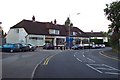
Residents of GU22 9NJ have access to five retail outlets, including Co-op Woking, Morrisons Daily, and Sainsburys Woking, ensuring convenience for shopping and daily essentials. The nearby rail stations and Fairoaks Airport enhance mobility, while the high broadband score supports remote work and digital lifestyles. Though specific parks or leisure facilities are not listed in the data, the area’s proximity to rail networks and retail hubs suggests a balance between urban convenience and potential green spaces in surrounding regions. The compact nature of the postcode means amenities are closely clustered, fostering a sense of community while meeting practical needs.
Amenities
Schools
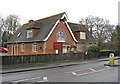
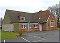
Near GU22 9NJ are two primary schools: Kingfield Primary School and Westfield First School. Both cater to younger children, though Kingfield Primary School has an Ofsted rating of ‘good’, indicating a higher standard of education. The presence of two primary schools within the area suggests accessibility for families with young children, reducing the need for long commutes. However, the absence of secondary schools or further education institutions means parents may need to consider nearby towns for older children. The mix of schools provides options, but the lack of data on secondary education highlights a potential gap in the area’s infrastructure for growing families.
| Rank | School | Type | Entry gender | Ages |
|---|
Explore more schools in this area
Go to Schools tabDemographics
The population of GU22 9NJ is predominantly adults aged 30–64, with a median age of 47. This suggests a mature community, likely with established careers and families. Home ownership is high at 78%, indicating a stable residential base rather than a transient rental market. The accommodation type is primarily houses, which may appeal to those seeking more space or privacy. The predominant ethnic group is White, though specific data on diversity or deprivation is not provided. The age profile implies a population that may be nearing retirement or in their peak working years, potentially influencing local services and amenities. With no data on deprivation levels, it is unclear how economic factors might affect quality of life, but the high home ownership rate suggests financial stability for many residents.
Household Size
Accommodation Type
Tenure
Ethnic Group
Religion
Household Composition
Age
Household Deprivation
NS-SEC
Explore more demographic insights in this area
Go to Demographics tabPlanning
Planning Constraints
- Flood RiskPremium
- Ramsar Wetland SitesPremium
- Area of Outstanding Natural BeautyPremium
- Protected Nature ReservePremium
- Protected WoodlandPremium