Area Overview for GU22 9JD
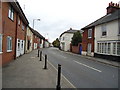
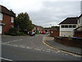
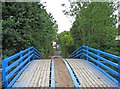
Photos of GU22 9JD


Area Information
Living in GU22 9JD means inhabiting a compact, residential postcode area of 1345 square metres, home to 1974 people. With a population density of 975 people per square kilometre, this is a tightly knit community where daily life is shaped by proximity to essential services. The area’s small size means it is likely to feel cohesive, with residents accustomed to knowing their neighbours. Its location offers practical access to nearby amenities, including supermarkets, rail stations, and an airport, blending suburban comfort with commuter convenience. The presence of multiple rail links, such as Worplesdon and West Byfleet stations, suggests it is well integrated into regional transport networks. For those seeking a balance between residential tranquillity and urban accessibility, GU22 9JD provides a compact footprint with a focus on essential living. The area’s low flood risk and absence of environmental constraints further enhance its appeal, ensuring residents face minimal planning or safety challenges. This is a place where practicality meets community, ideal for those prioritising stability and connectivity.
- Area Type
- Postcode
- Area Size
- 1345 m²
- Population
- 1974
- Population Density
- 975 people/km²
The property market in GU22 9JD is characterised by high home ownership (73%) and a focus on houses rather than flats or apartments. This indicates a community where homeownership is the norm, and the housing stock is likely to consist of family homes or semi-detached properties. Given the area’s small size and the prevalence of houses, the market is not dominated by rental properties, making it a less volatile environment for buyers. The limited number of properties available may mean competition for homes, particularly for those seeking specific features or locations within the postcode. For buyers, this suggests a market where stability and long-term investment are key, though the small area size may restrict options for those needing larger or more varied housing types. The absence of flats also means the area may cater less to younger professionals or students.
House Prices in GU22 9JD
Showing 15 properties
| Address | Type | Beds | Baths | Last Sale Price | Last Sale Date | |
|---|---|---|---|---|---|---|
| 11, Townsend Cottages, Townsend Lane, Old Woking, Woking, GU22 9JD | Terraced | 2 | 1 | £300,000 | Nov 2022 | |
| 5, Townsend Cottages, Townsend Lane, Old Woking, Woking, GU22 9JD | Maisonette | 1 | 1 | £205,000 | Mar 2022 | |
| 14, Townsend Cottages, Townsend Lane, Old Woking, Woking, GU22 9JD | Maisonette | 1 | 1 | £212,500 | Jun 2021 | |
| 8, Townsend Cottages, Townsend Lane, Old Woking, Woking, GU22 9JD | Maisonette | 1 | 1 | £199,950 | Aug 2020 | |
| 17, Townsend Cottages, Townsend Lane, Old Woking, Woking, GU22 9JD | Cottage | 2 | 1 | £270,000 | Feb 2020 | |
| 16, Townsend Cottages, Townsend Lane, Old Woking, Woking, GU22 9JD | Terraced | 2 | 1 | £260,000 | Feb 2019 | |
| 7, Townsend Cottages, Townsend Lane, Old Woking, Woking, GU22 9JD | Maisonette | 1 | 1 | £185,000 | Aug 2016 | |
| 15, Townsend Cottages, Townsend Lane, Old Woking, Woking, GU22 9JD | Terraced | 2 | 1 | £262,000 | May 2016 | |
| 13, Townsend Cottages, Townsend Lane, Old Woking, Woking, GU22 9JD | Flat | - | - | £128,000 | Feb 2013 | |
| 12, Townsend Cottages, Townsend Lane, Old Woking, Woking, GU22 9JD | house | 1 | 1 | £177,500 | May 2011 |
Energy Efficiency in GU22 9JD
Residents of GU22 9JD have access to a range of nearby amenities, including five retail outlets such as Budgens Rydens, Sainsburys Woking, and Morrisons Daily. These supermarkets provide convenience for daily shopping, reducing the need to travel further for essentials. The area’s rail stations—Worplesdon, West Byfleet, and Clandon—offer easy access to public transport, linking to broader networks for commuting or leisure trips. The proximity to Fairoaks Airport adds to the area’s connectivity, enabling travel to regional and international destinations. While the data does not specify parks or leisure facilities, the presence of multiple retail and transport options suggests a lifestyle focused on practicality and accessibility. The compact nature of the area means amenities are within practical reach, supporting a self-contained community where residents can meet daily needs without long journeys.
Amenities
Schools
| Rank | School | Type | Entry gender | Ages |
|---|
Explore more schools in this area
Go to Schools tabDemographics
The community in GU22 9JD is predominantly composed of adults aged 30–64, with a median age of 47. This suggests a mature, established population, likely with strong ties to local institutions and a focus on long-term residency. Home ownership is high at 73%, indicating a stable housing market where most residents live in their own homes rather than renting. The accommodation type is primarily houses, which aligns with the area’s residential character and may reflect a preference for family-oriented living. The predominant ethnic group is White, though no specific data on diversity or deprivation is provided. The age profile and ownership figures suggest a community that values security and continuity, with fewer transient residents. This demographic mix likely supports a local economy centred on services and amenities catering to middle-aged and older households.
Household Size
Accommodation Type
Tenure
Ethnic Group
Religion
Household Composition
Age
Household Deprivation
NS-SEC
Explore more demographic insights in this area
Go to Demographics tabPlanning
Planning Constraints
- Flood RiskPremium
- Ramsar Wetland SitesPremium
- Area of Outstanding Natural BeautyPremium
- Protected Nature ReservePremium
- Protected WoodlandPremium