Area Overview for GU22 8UW
Photos of GU22 8UW
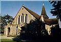
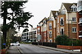
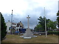
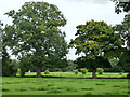
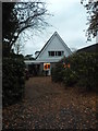
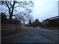
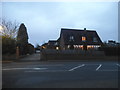
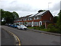
58 photos from this area
Area Information
Key information about the GU22 8UW including its size, population, and administrative classification.
- Area Type
- Postcode
- Area Size
- 1.7 hectares
- Population
- 1925
- Population Density
- 1049 people/km²
House Prices in GU22 8UW
6
Properties
£546,667
Average Sold Price
£17,000
Lowest Price
£1,075,000
Highest Price
Showing 6 properties
| Address | Type | Beds | Baths | Last Sale Price | Last Sale Date | |
|---|---|---|---|---|---|---|
| Oakburn, Dodds Lane, Pyrford, Woking, GU22 8UW | house | - | - | £1,075,000 | May 2022 | |
| Jolly Robins, Dodds Lane, Pyrford, Woking, GU22 8UW | Detached | 4 | 2 | £17,000 | Aug 2021 | |
| Springfield, Dodds Lane, Pyrford, Woking, GU22 8UW | Semi-detached | 3 | 1 | £608,000 | Mar 2018 | |
| Thimble Cottage, 8 Dodds Lane, Pyrford, Woking, GU22 8UW | house | - | - | £780,000 | Dec 2015 | |
| Pyrcroft, Dodds Lane, Pyrford, Woking, GU22 8UW | Semi-detached | - | - | £465,000 | Jul 2012 | |
| Anvil Cottage, 9 Dodds Lane, Pyrford, Woking, GU22 8UW | Semi-detached | - | - | £335,000 | Oct 2002 |
Energy Efficiency in GU22 8UW
Amenities
Schools
| Rank | School | Type | Entry gender | Ages |
|---|
Explore more schools in this area
Go to Schools tabDemographics
Household Size
Family (3-5 people)
most common
Accommodation Type
Houses
most common
Tenure
81
majority
Ethnic Group
White
most common
Religion
N/A
most common
Household Composition
N/A
most common
Age
47
median
Adults (30-64 years)
most common
Household Deprivation
N/A
with no deprivation
NS-SEC
56
in Lower managerial occupations
Explore more demographic insights in this area
Go to Demographics tabPlanning
Planning Constraints
- Flood RiskPremium
- Ramsar Wetland SitesPremium
- Area of Outstanding Natural BeautyPremium
- Protected Nature ReservePremium
- Protected WoodlandPremium