Area Overview for GU22 8TP
Photos of GU22 8TP
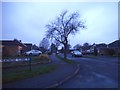
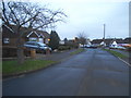
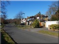
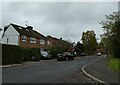
37 photos from this area
Area Information
Key information about the GU22 8TP including its size, population, and administrative classification.
- Area Type
- Postcode
- Area Size
- 1.7 hectares
- Population
- 1473
- Population Density
- 342 people/km²
House Prices in GU22 8TP
24
Properties
£441,795
Average Sold Price
£155,000
Lowest Price
£720,000
Highest Price
Showing 24 properties
| Address | Type | Beds | Baths | Last Sale Price | Last Sale Date | |
|---|---|---|---|---|---|---|
| 1 Romans Way, Pyrford, Woking, GU22 8TP | house | 4 | 2 | £515,000 | Jun 2021 | |
| 23 Romans Way, Pyrford, Woking, GU22 8TP | Bungalow | - | - | £600,000 | Jul 2020 | |
| 22 Romans Way, Pyrford, Woking, GU22 8TP | Detached | 4 | 3 | £636,000 | Oct 2019 | |
| 7 Romans Way, Pyrford, Woking, GU22 8TP | Detached | 4 | 2 | £720,000 | Oct 2019 | |
| 12 Romans Way, Pyrford, Woking, GU22 8TP | Semi-detached | 3 | 1 | £499,000 | Sep 2018 | |
| 9 Romans Way, Pyrford, Woking, GU22 8TP | Bungalow | 3 | 1 | £644,000 | Jun 2018 | |
| 18 Romans Way, Pyrford, Woking, GU22 8TP | house | - | - | £600,000 | Feb 2016 | |
| 17 Romans Way, Pyrford, Woking, GU22 8TP | Semi-detached | 4 | 2 | £437,000 | Oct 2014 | |
| 13 Romans Way, Pyrford, Woking, GU22 8TP | Bungalow | 4 | - | £585,000 | Sep 2013 | |
| 6 Romans Way, Pyrford, Woking, GU22 8TP | Bungalow | 4 | - | £535,000 | Aug 2012 |
Page 1 of 3
Energy Efficiency in GU22 8TP
Amenities
Schools
| Rank | School | Type | Entry gender | Ages |
|---|
Explore more schools in this area
Go to Schools tabDemographics
Household Size
One person
most common
Accommodation Type
Houses
most common
Tenure
85
majority
Ethnic Group
White
most common
Religion
N/A
most common
Household Composition
N/A
most common
Age
47
median
Adults (30-64 years)
most common
Household Deprivation
N/A
with no deprivation
NS-SEC
48
in Lower managerial occupations
Explore more demographic insights in this area
Go to Demographics tabPlanning
Planning Constraints
- Flood RiskPremium
- Ramsar Wetland SitesPremium
- Area of Outstanding Natural BeautyPremium
- Protected Nature ReservePremium
- Protected WoodlandPremium