Area Overview for GU22 8TH
Photos of GU22 8TH
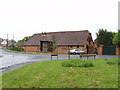
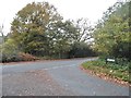
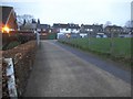

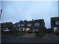
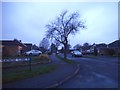
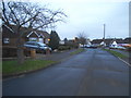
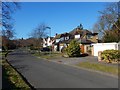
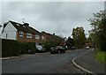
37 photos from this area
Area Information
Key information about the GU22 8TH including its size, population, and administrative classification.
- Area Type
- Postcode
- Area Size
- 4.4 hectares
- Population
- 1473
- Population Density
- 342 people/km²
House Prices in GU22 8TH
23
Properties
£844,996
Average Sold Price
£420,000
Lowest Price
£1,500,000
Highest Price
Showing 23 properties
| Address | Type | Beds | Baths | Last Sale Price | Last Sale Date | |
|---|---|---|---|---|---|---|
| St Margarets, Aviary Road, Pyrford, Woking, GU22 8TH | Detached | 5 | - | £1,250,000 | Sep 2015 | |
| Tudor Lodge, Aviary Road, Pyrford, Woking, GU22 8TH | Detached | 4 | 3 | £796,950 | Dec 2014 | |
| Urquhart House, Aviary Road, Pyrford, Woking, GU22 8TH | Detached | 7 | - | £1,500,000 | Aug 2013 | |
| Lincoln House, Aviary Road, Pyrford, Woking, GU22 8TH | house | - | - | £945,000 | May 2013 | |
| Mark House, Aviary Road, Pyrford, Woking, GU22 8TH | Detached | 4 | 2 | £918,500 | Jan 2013 | |
| Kingswood, Aviary Road, Pyrford, Woking, GU22 8TH | Detached | 4 | 2 | £905,000 | Jul 2012 | |
| Little Orchard, Aviary Road, Pyrford, Woking, GU22 8TH | house | - | - | £602,500 | Apr 2010 | |
| Khandala, Aviary Road, Pyrford, Woking, GU22 8TH | Detached | - | - | £739,500 | Aug 2009 | |
| Pinehurst, Aviary Road, Pyrford, Woking, GU22 8TH | Detached | - | - | £840,000 | Oct 2006 | |
| Rostellan, Aviary Road, Pyrford, Woking, GU22 8TH | Detached | - | - | £760,000 | Apr 2006 |
Page 1 of 3
Energy Efficiency in GU22 8TH
Amenities
Schools
| Rank | School | Type | Entry gender | Ages |
|---|
Explore more schools in this area
Go to Schools tabDemographics
Household Size
One person
most common
Accommodation Type
Houses
most common
Tenure
85
majority
Ethnic Group
White
most common
Religion
N/A
most common
Household Composition
N/A
most common
Age
47
median
Adults (30-64 years)
most common
Household Deprivation
N/A
with no deprivation
NS-SEC
48
in Lower managerial occupations
Explore more demographic insights in this area
Go to Demographics tabPlanning
Planning Constraints
- Flood RiskPremium
- Ramsar Wetland SitesPremium
- Area of Outstanding Natural BeautyPremium
- Protected Nature ReservePremium
- Protected WoodlandPremium