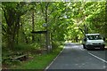
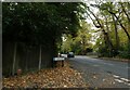
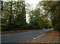
Area Overview for GU22 8QW
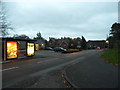
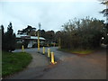
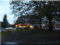
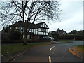
Photos of GU22 8QW

Area Information
GU22 8QW is a compact residential postcode in England, spanning 8,896 square metres and home to 1,869 residents. Its high population density of 210,093 people per square kilometre reflects a tightly knit community, though the area’s small size means it is best suited for those prioritising proximity to local amenities over expansive living space. The postcode is part of a cluster of homes, predominantly owner-occupied, with a strong presence of family households. Daily life here is shaped by its proximity to schools, rail networks, and retail hubs. Residents benefit from easy access to Pyrford Primary School and nearby independent institutions like Oakfield School, while the area’s rail links to West Byfleet and Addlestone stations offer swift connections to larger towns. The low crime risk score of 91 and minimal environmental constraints, such as no protected woodlands or wetlands, make it a practical choice for buyers seeking a safe, functional neighbourhood without complex planning restrictions.
- Area Type
- Postcode
- Area Size
- 8896 m²
- Population
- 1869
- Population Density
- 2091 people/km²
GU22 8QW is predominantly an owner-occupied area, with 93% of homes owned by residents rather than rented. This suggests a market characterised by long-term residency and limited turnover, which can stabilise property values but may also reduce availability for buyers seeking short-term investment opportunities. The accommodation type is exclusively houses, indicating a lack of high-density housing or rental flats. This makes the area more suited to families or individuals prioritising space and privacy over affordability. Given the postcode’s small size and high population density, the housing stock is likely limited, meaning buyers may need to consider nearby areas for more options. The owner-occupied nature of the market also implies lower demand for rental properties, which could affect local letting activity.
House Prices in GU22 8QW
Showing 6 properties
| Address | Type | Beds | Baths | Last Sale Price | Last Sale Date | |
|---|---|---|---|---|---|---|
| Woodmere, 2 Orchard Lea Close, Pyrford, Woking, GU22 8QW | Bungalow | 4 | 2 | £890,000 | Sep 2023 | |
| Orchard Lea, Orchard Lea Close, Pyrford, Woking, GU22 8QW | Bungalow | 3 | 1 | £1,700,000 | Aug 2007 | |
| Homelea, 3 Orchard Lea Close, Pyrford, Woking, GU22 8QW | Detached | 5 | 3 | - | - | |
| Larkspur, 1 Orchard Lea Close, Pyrford, Woking, GU22 8QW | Bungalow | 3 | 2 | - | - | |
| 5 Orchard Lea Close, Pyrford, Woking, GU22 8QW | Detached | - | - | - | - | |
| Ashdell, 4 Orchard Lea Close, Pyrford, Woking, GU22 8QW | Detached | - | - | - | - |
Energy Efficiency in GU22 8QW
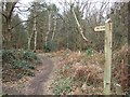
The lifestyle in GU22 8QW is shaped by its proximity to retail, transport, and recreational facilities. Nearby shops include Co-op Pyrford, Asda Woking, and Tesco Old Woking, offering everyday essentials within practical reach. The area’s rail stations connect residents to broader networks, while Fairoaks Airport provides access to regional and international travel. Ferry services at Weybridge and Shepperton add to the transport diversity, enabling water-based commuting. The compact nature of the postcode means residents must venture slightly beyond GU22 8QW for larger leisure options, but the availability of local amenities ensures daily needs are met. The balance of retail, transport, and green spaces (though no specific parks are listed) creates a functional, if modest, lifestyle for those prioritising convenience over sprawling urban or rural environments.
Amenities
Schools
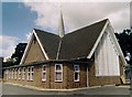
GU22 8QW is served by a range of primary and independent schools, offering families diverse educational choices. Pyrford Primary School and Pyrford Church of England Aided Primary School provide state-funded education, while independent institutions like Oakfield School and Highfield School cater to those seeking fee-paying options. Pyrford Middle School, also a primary school, adds to the local network. The presence of both state and independent schools ensures parents can select between free education and private schooling, depending on their priorities. This mix supports families across different financial circumstances, though the absence of secondary schools in the immediate area may require commuting for older students. The quality of local schools is a key draw for buyers prioritising education for their children.
| Rank | School | Type | Entry gender | Ages |
|---|
Explore more schools in this area
Go to Schools tabDemographics
The population of GU22 8QW skews towards adults aged 30–64, with a median age of 47. This suggests a community rooted in established families and professionals, rather than a transient or student demographic. Home ownership is exceptionally high at 93%, indicating a stable, long-term resident base. The area is composed almost entirely of houses, reflecting a preference for detached or semi-detached properties over flats. The predominant ethnic group is White, which aligns with broader regional trends. While no specific deprivation data is provided, the high home ownership rate and low crime risk imply a relatively affluent, secure environment. The absence of significant demographic diversity, however, may limit cultural or social variety for some residents.
Household Size
Accommodation Type
Tenure
Ethnic Group
Religion
Household Composition
Age
Household Deprivation
NS-SEC
Explore more demographic insights in this area
Go to Demographics tabPlanning
Planning Constraints
- Flood RiskPremium
- Ramsar Wetland SitesPremium
- Area of Outstanding Natural BeautyPremium
- Protected Nature ReservePremium
- Protected WoodlandPremium