Area Overview for GU22 8LN
Photos of GU22 8LN

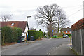
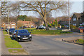
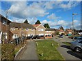
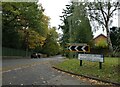
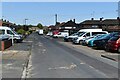


21 photos from this area
Area Information
Key information about the GU22 8LN including its size, population, and administrative classification.
- Area Type
- Postcode
- Area Size
- 1.3 hectares
- Population
- 1523
- Population Density
- 1613 people/km²
House Prices in GU22 8LN
16
Properties
£457,177
Average Sold Price
£94,950
Lowest Price
£825,000
Highest Price
Showing 16 properties
| Address | Type | Beds | Baths | Last Sale Price | Last Sale Date | |
|---|---|---|---|---|---|---|
| 5 Belmore Avenue, Pyrford, Woking, GU22 8LN | Semi-detached | 4 | 2 | £745,000 | Aug 2023 | |
| Woodlands, 4 Belmore Avenue, Pyrford, Woking, GU22 8LN | Bungalow | - | - | £825,000 | Jun 2021 | |
| 9 Belmore Avenue, Pyrford, Woking, GU22 8LN | Semi-detached | 3 | 1 | £800,000 | Jan 2020 | |
| Cedar Hollow, 13 Belmore Avenue, Pyrford, Woking, GU22 8LN | Detached | 4 | - | £610,000 | Jan 2016 | |
| 16 Belmore Avenue, Pyrford, Woking, GU22 8LN | Semi-detached | 3 | 2 | £355,000 | Jan 2014 | |
| 7 Belmore Avenue, Pyrford, Woking, GU22 8LN | house | 3 | - | £378,000 | Oct 2010 | |
| 6 Belmore Avenue, Pyrford, Woking, GU22 8LN | Detached | - | - | £375,000 | Mar 2006 | |
| Chalet Alpenblick, 18 Belmore Avenue, Pyrford, Woking, GU22 8LN | Semi-detached | - | - | £295,000 | Sep 2005 | |
| 12 Belmore Avenue, Pyrford, Woking, GU22 8LN | Detached | 4 | - | £346,000 | May 2002 | |
| 8 Belmore Avenue, Pyrford, Woking, GU22 8LN | house | - | - | £205,000 | Feb 1999 |
Page 1 of 2
Energy Efficiency in GU22 8LN
Amenities
Schools
| Rank | School | Type | Entry gender | Ages |
|---|
Explore more schools in this area
Go to Schools tabDemographics
Household Size
Family (3-5 people)
most common
Accommodation Type
Houses
most common
Tenure
95
majority
Ethnic Group
White
most common
Religion
N/A
most common
Household Composition
N/A
most common
Age
47
median
Adults (30-64 years)
most common
Household Deprivation
N/A
with no deprivation
NS-SEC
59
in Lower managerial occupations
Explore more demographic insights in this area
Go to Demographics tabPlanning
Planning Constraints
- Flood RiskPremium
- Ramsar Wetland SitesPremium
- Area of Outstanding Natural BeautyPremium
- Protected Nature ReservePremium
- Protected WoodlandPremium