Area Overview for GU22 8JT
Photos of GU22 8JT

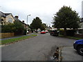
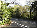
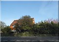
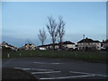
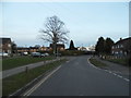
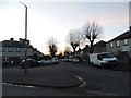
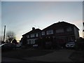

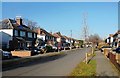
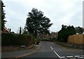
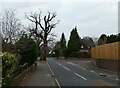
43 photos from this area
Area Information
Key information about the GU22 8JT including its size, population, and administrative classification.
- Area Type
- Postcode
- Area Size
- 1.5 hectares
- Population
- 1974
- Population Density
- 975 people/km²
House Prices in GU22 8JT
28
Properties
£274,367
Average Sold Price
£100,000
Lowest Price
£507,500
Highest Price
Showing 28 properties
| Address | Type | Beds | Baths | Last Sale Price | Last Sale Date | |
|---|---|---|---|---|---|---|
| 21 Baynton Road, Old Woking, Woking, GU22 8JT | Terraced | 4 | 2 | £507,500 | Dec 2021 | |
| 18 Baynton Road, Old Woking, Woking, GU22 8JT | house | 3 | - | £425,000 | Nov 2021 | |
| 25 Baynton Road, Old Woking, Woking, GU22 8JT | house | - | - | £455,000 | Jun 2021 | |
| 15 Baynton Road, Old Woking, Woking, GU22 8JT | house | - | - | £160,000 | Mar 2021 | |
| 6 Baynton Road, Old Woking, Woking, GU22 8JT | Semi-detached | 3 | 1 | £430,000 | Dec 2018 | |
| 19 Baynton Road, Old Woking, Woking, GU22 8JT | Terraced | 3 | 2 | £400,000 | Oct 2016 | |
| 23 Baynton Road, Old Woking, Woking, GU22 8JT | Terraced | 3 | 2 | £450,000 | Jul 2016 | |
| 9 Baynton Road, Old Woking, Woking, GU22 8JT | house | - | - | £130,000 | Jul 2014 | |
| 11 Baynton Road, Old Woking, Woking, GU22 8JT | Terraced | 3 | - | £110,000 | Aug 2013 | |
| 27 Baynton Road, Old Woking, Woking, GU22 8JT | Terraced | 2 | 2 | £268,000 | Jun 2013 |
Page 1 of 3
Energy Efficiency in GU22 8JT
Amenities
Schools
| Rank | School | Type | Entry gender | Ages |
|---|
Explore more schools in this area
Go to Schools tabDemographics
Household Size
Family (3-5 people)
most common
Accommodation Type
Houses
most common
Tenure
73
majority
Ethnic Group
White
most common
Religion
N/A
most common
Household Composition
N/A
most common
Age
47
median
Adults (30-64 years)
most common
Household Deprivation
N/A
with no deprivation
NS-SEC
43
in Lower managerial occupations
Explore more demographic insights in this area
Go to Demographics tabPlanning
Planning Constraints
- Flood RiskPremium
- Ramsar Wetland SitesPremium
- Area of Outstanding Natural BeautyPremium
- Protected Nature ReservePremium
- Protected WoodlandPremium