Area Overview for GU22 8JG
Photos of GU22 8JG
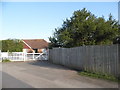
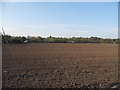
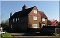
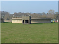
32 photos from this area
Area Information
Key information about the GU22 8JG including its size, population, and administrative classification.
- Area Type
- Postcode
- Area Size
- 58.8 hectares
- Population
- 1974
- Population Density
- 975 people/km²
House Prices in GU22 8JG
7
Properties
£689,056
Average Sold Price
£250,000
Lowest Price
£1,565,000
Highest Price
Showing 7 properties
| Address | Type | Beds | Baths | Last Sale Price | Last Sale Date | |
|---|---|---|---|---|---|---|
| Almondbury, Carters Lane, Old Woking, Woking, GU22 8JG | Semi-detached | 4 | 3 | £606,224 | Nov 2024 | |
| The Barn, Carters Lane, Old Woking, Woking, GU22 8JG | Retail | 5 | 3 | £1,565,000 | Sep 2022 | |
| Burnlea, Carters Lane, Old Woking, Woking, GU22 8JG | house | - | - | £335,000 | Sep 2009 | |
| Burcot, Carters Lane, Old Woking, Woking, GU22 8JG | house | - | - | £250,000 | Jun 2001 | |
| 22 Carters Lane, Old Woking, Woking, GU22 8JG | Semi-detached | - | - | - | - | |
| Park Farm House, Carters Lane, Old Woking, Woking, GU22 8JG | Detached | - | - | - | - | |
| Barn End, The Barn, Carters Lane, Old Woking, Woking, GU22 8JG | Detached | 1 | 1 | - | - |
Energy Efficiency in GU22 8JG
Amenities
Schools
| Rank | School | Type | Entry gender | Ages |
|---|
Explore more schools in this area
Go to Schools tabDemographics
Household Size
Family (3-5 people)
most common
Accommodation Type
Houses
most common
Tenure
73
majority
Ethnic Group
White
most common
Religion
N/A
most common
Household Composition
N/A
most common
Age
47
median
Adults (30-64 years)
most common
Household Deprivation
N/A
with no deprivation
NS-SEC
43
in Lower managerial occupations
Explore more demographic insights in this area
Go to Demographics tabPlanning
Planning Constraints
- Flood RiskPremium
- Ramsar Wetland SitesPremium
- Area of Outstanding Natural BeautyPremium
- Protected Nature ReservePremium
- Protected WoodlandPremium