Area Overview for GU22 7RR
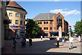
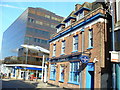
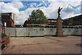
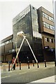
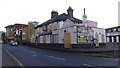
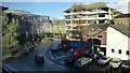
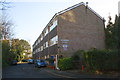
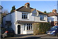
Photos of GU22 7RR


Area Information
Living in GU22 7RR means inhabiting a compact, high-density residential cluster in England. With a population of 1,655 spread over 1,066 square metres, this area is densely populated, reflecting a small, tightly knit community. Its proximity to Woking and surrounding rail networks positions it as a practical choice for commuters. The area’s low flood risk and below-average crime rate—scoring 79/100—suggest a safe, stable environment. While the housing stock is predominantly flats, the area’s size means residents are likely to know their neighbours. Daily life here is shaped by nearby amenities, including retail hubs and rail links, making it convenient for those prioritising accessibility over sprawling open spaces. The absence of protected natural sites or planning constraints adds to its straightforward appeal, though the high population density may influence the pace of life. For buyers seeking a compact, well-connected home with minimal environmental risks, GU22 7RR offers a blend of practicality and security.
- Area Type
- Postcode
- Area Size
- 1066 m²
- Population
- 1655
- Population Density
- 9024 people/km²
The property market in GU22 7RR is defined by its high density and flat-dominated housing stock. With 44% of homes owned by residents, the area leans more towards rental than owner-occupied, though the data does not clarify the exact balance. Flats are the predominant accommodation type, which may appeal to those prioritising convenience over larger living spaces. The compact nature of the area means buyers must consider proximity to shared facilities and limited private outdoor areas. For those seeking a home in this small postcode, the focus is on practicality: flats may offer lower maintenance costs and easier access to nearby amenities. However, the high population density could impact property values, with demand likely driven by commuters relying on rail links to Woking and surrounding areas.
House Prices in GU22 7RR
No properties found in this postcode.
Energy Efficiency in GU22 7RR
The lifestyle in GU22 7RR is shaped by its proximity to retail and transport hubs. Within practical reach are major retailers like Tesco Woking and M&S Woking, offering everyday shopping needs. Rail stations such as Worplesdon and West Byfleet provide easy access to Woking’s town centre, where more amenities and leisure options are available. Fairoaks Airport, just 1 kilometre away, adds convenience for frequent flyers. While the area itself is small, its location ensures residents can access a broader range of services without long commutes. The presence of multiple rail stations also supports a commuter-centric lifestyle, with opportunities to blend local convenience with regional connectivity. However, the area lacks detailed information on parks or leisure facilities, suggesting a focus on practicality over expansive recreational spaces.
Amenities
Schools
| Rank | School | Type | Entry gender | Ages |
|---|
Explore more schools in this area
Go to Schools tabDemographics
The community in GU22 7RR is predominantly middle-aged, with a median age of 47 and the majority of residents falling within the 30-64 age range. Home ownership stands at 44%, with flats being the primary accommodation type. This suggests a mix of owner-occupied and rental properties, though the data does not specify the proportion of each. The predominant ethnic group is White, and while no specific deprivation data is provided, the high population density—1.55 million people per square kilometre—may indicate a concentration of households in a limited space. This density could influence the character of daily life, fostering a close-knit environment but potentially limiting private outdoor space. The age profile suggests a stable population, with fewer young families or retirees, shaping local services and amenities to cater to working-age adults.
Household Size
Accommodation Type
Tenure
Ethnic Group
Religion
Household Composition
Age
Household Deprivation
NS-SEC
Explore more demographic insights in this area
Go to Demographics tabPlanning
Planning Constraints
- Flood RiskPremium
- Ramsar Wetland SitesPremium
- Area of Outstanding Natural BeautyPremium
- Protected Nature ReservePremium
- Protected WoodlandPremium