Area Overview for GU22 7LE
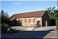
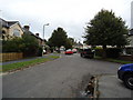
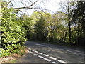
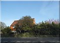
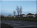
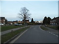
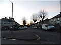
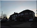
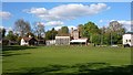
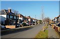
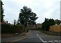
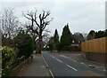
Photos of GU22 7LE
Area Information
Living in GU22 7LE offers a compact, residential experience in a small cluster of homes with a population of 1,435 people. The area spans just 1.4 hectares, creating a tight-knit community with a population density of 647 people per square kilometre. This is a place where daily life is shaped by proximity to essential services and a low crime rate. The area’s appeal lies in its balance of convenience and quietude, with easy access to nearby rail networks and independent schools. Residents here are predominantly adults aged 30-64, many of whom own their homes. The small size of the postcode means that amenities and services are within walking or short driving distance, fostering a sense of local cohesion. While not a sprawling suburb, GU22 7LE is well-connected to larger towns via rail, offering access to broader opportunities without the pressures of urban density. For those seeking a stable, family-friendly environment with practical infrastructure, this area provides a straightforward, no-frills living experience.
- Area Type
- Postcode
- Area Size
- 1.4 hectares
- Population
- 1435
- Population Density
- 647 people/km²
The property market in GU22 7LE is dominated by owner-occupied homes, with 83% of residents living in properties they own. This high rate of home ownership suggests a stable market with limited rental demand, making it more attractive to buyers seeking long-term investment rather than short-term tenancy. The accommodation type is primarily houses, which is typical for smaller, low-density areas. This means properties here are likely to be larger than flats, offering more space and privacy. The small size of the postcode—just 1.4 hectares—means the housing stock is limited, and buyers should consider the immediate surrounding areas for more options. For those prioritising ownership over rental flexibility, GU22 7LE offers a straightforward choice, though the lack of high-rise or mixed-use developments may limit diversity in property types.
House Prices in GU22 7LE
Showing 13 properties
| Address | Type | Beds | Baths | Last Sale Price | Last Sale Date | |
|---|---|---|---|---|---|---|
| 8 Rosewood, Woking, GU22 7LE | Detached | 5 | 2 | £1,062,500 | Nov 2023 | |
| Pointers Lodge, 13 Rosewood, Woking, GU22 7LE | Detached | 5 | 2 | £1,070,000 | Nov 2022 | |
| 3 Rosewood, Woking, GU22 7LE | Detached | 5 | 2 | £1,300,000 | Jan 2022 | |
| 10 Rosewood, Woking, GU22 7LE | Detached | 5 | 3 | £1,090,000 | Dec 2020 | |
| Tudor, 5 Rosewood, Woking, GU22 7LE | house | 5 | 2 | £1,005,000 | Nov 2015 | |
| 7 Rosewood, Woking, GU22 7LE | house | - | - | £780,000 | Dec 2009 | |
| Blenheim, 9 Rosewood, Woking, GU22 7LE | Detached | - | - | £345,000 | May 1998 | |
| 2 Rosewood, Woking, GU22 7LE | Detached | 5 | 3 | - | - | |
| 4 Rosewood, Woking, GU22 7LE | Detached | - | - | - | - | |
| Folgate, 6 Rosewood, Woking, GU22 7LE | Detached | - | - | - | - |
Energy Efficiency in GU22 7LE
Residents of GU22 7LE have access to a range of amenities within practical reach. The area is near retail outlets such as Tesco Woking, Budgens Rydens, and M&S Woking Rail SF, offering everyday shopping needs. Rail stations like Worplesdon and Brookwood provide easy access to nearby towns, while Fairoaks Airport is a short distance away for those requiring air travel. The presence of these services means daily life is convenient, with minimal need to travel far for essentials. Though the data does not specify parks or leisure facilities, the proximity to rail and retail suggests a functional lifestyle focused on practicality. The small size of the postcode means the character of the area is defined by its immediate surroundings, with a balance between residential tranquillity and accessible infrastructure.
Amenities
Schools
Residents of GU22 7LE have access to two independent schools: Hoe Bridge School and Trees School. Both are private institutions, offering alternative educational options for families seeking non-state schooling. The presence of independent schools suggests a community that values choice in education, though no Ofsted ratings are provided in the data. For families prioritising private education, these schools are conveniently located within the area’s immediate vicinity. However, the absence of state schools in the data means buyers should verify additional educational options beyond the postcode. The mix of school types may appeal to parents looking for structured, fee-based education, though it also means the area may cater more to households with the financial capacity to afford private schooling.
| Rank | School | Type | Entry gender | Ages |
|---|
Explore more schools in this area
Go to Schools tabDemographics
The community in GU22 7LE is predominantly composed of adults aged 30-64, with a median age of 47. This suggests a mature population, likely with established careers and families. Home ownership is high, with 83% of residents living in properties they own, indicating a stable housing market. The accommodation types here are primarily houses, which aligns with the area’s low population density and residential character. The predominant ethnic group is White, reflecting a homogenous demographic profile. While no specific data on deprivation is provided, the high home ownership rate and low crime risk suggest a generally affluent and secure environment. The absence of significant diversity data means the community’s social fabric is likely shaped by long-term residents rather than recent migration. For buyers, this profile implies a neighbourhood with steady demand for owner-occupied homes and a focus on family-centric living.
Household Size
Accommodation Type
Tenure
Ethnic Group
Religion
Household Composition
Age
Household Deprivation
NS-SEC
Explore more demographic insights in this area
Go to Demographics tabPlanning
Planning Constraints
- Flood RiskPremium
- Ramsar Wetland SitesPremium
- Area of Outstanding Natural BeautyPremium
- Protected Nature ReservePremium
- Protected WoodlandPremium