Area Overview for GU22 0RD
Photos of GU22 0RD
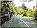
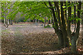
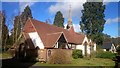
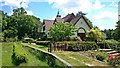
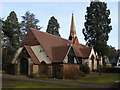
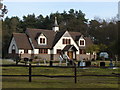
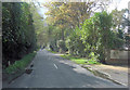
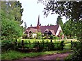
29 photos from this area
Area Information
Key information about the GU22 0RD including its size, population, and administrative classification.
- Area Type
- Postcode
- Area Size
- 8.1 hectares
- Population
- 1349
- Population Density
- 222 people/km²
House Prices in GU22 0RD
10
Properties
£1,023,917
Average Sold Price
£585,000
Lowest Price
£1,568,500
Highest Price
Showing 10 properties
| Address | Type | Beds | Baths | Last Sale Price | Last Sale Date | |
|---|---|---|---|---|---|---|
| Woodleigh, Heath House Road, Brookwood, Woking, GU22 0RD | Semi-detached | 3 | 2 | £955,000 | Dec 2023 | |
| Heath House, Heath House Road, Brookwood, Woking, GU22 0RD | Detached | 4 | 2 | £1,115,000 | Jun 2015 | |
| 2, Eastgate Cottages, Heath House Road, Brookwood, Woking, GU22 0RD | Semi-detached | 4 | 2 | £585,000 | Oct 2013 | |
| Keir Lodge, Heath House Road, Brookwood, Woking, GU22 0RD | Detached | - | - | £1,170,000 | Dec 2006 | |
| Breinton, Heath House Road, Brookwood, Woking, GU22 0RD | Detached | - | - | £1,568,500 | Aug 2005 | |
| Windlecote House, Heath House Road, Brookwood, Woking, GU22 0RD | Detached | - | - | £750,000 | Dec 1996 | |
| Woodside Cottage, Heath House Road, Brookwood, Woking, GU22 0RD | Detached | 3 | 2 | - | - | |
| Tennis 43M From Keir Lodge, Heath House Road 69M From Heath House Road, Heath House Road, Brookwood, Woking, GU22 0RD | Leisure | - | - | - | - | |
| Greenacre, Heath House Road, Brookwood, Woking, GU22 0RD | Semi-detached | - | - | - | - | |
| Hunters End, Heath House Road, Brookwood, Woking, GU22 0RD | house | - | - | - | - |
Energy Efficiency in GU22 0RD
Amenities
Schools
| Rank | School | Type | Entry gender | Ages |
|---|
Explore more schools in this area
Go to Schools tabDemographics
Household Size
Family (3-5 people)
most common
Accommodation Type
Houses
most common
Tenure
84
majority
Ethnic Group
White
most common
Religion
N/A
most common
Household Composition
N/A
most common
Age
47
median
Adults (30-64 years)
most common
Household Deprivation
N/A
with no deprivation
NS-SEC
53
in Lower managerial occupations
Explore more demographic insights in this area
Go to Demographics tabPlanning
Planning Constraints
- Flood RiskPremium
- Ramsar Wetland SitesPremium
- Area of Outstanding Natural BeautyPremium
- Protected Nature ReservePremium
- Protected WoodlandPremium