Area Overview for GU22 0QE
Photos of GU22 0QE
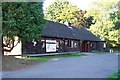
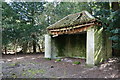
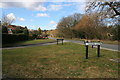
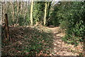
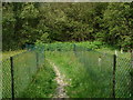
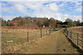
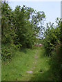
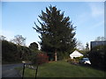
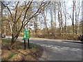
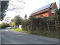
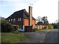
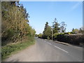
35 photos from this area
Area Information
Key information about the GU22 0QE including its size, population, and administrative classification.
- Area Type
- Postcode
- Area Size
- 9.5 hectares
- Population
- 1494
- Population Density
- 855 people/km²
House Prices in GU22 0QE
24
Properties
£1,250,970
Average Sold Price
£265,000
Lowest Price
£4,298,992
Highest Price
Showing 24 properties
| Address | Type | Beds | Baths | Last Sale Price | Last Sale Date | |
|---|---|---|---|---|---|---|
| Borrowa, Hook Heath Road, Woking, GU22 0QE | Detached | 4 | 3 | £1,280,000 | Oct 2025 | |
| Brackenbrae, Hook Heath Road, Woking, GU22 0QE | Detached | 4 | 4 | £1,583,000 | Feb 2025 | |
| Lansbury, Hook Heath Road, Woking, GU22 0QE | house | - | - | £3,000,000 | Nov 2022 | |
| Gainford, Hook Heath Road, Woking, GU22 0QE | Detached | 4 | 2 | £910,000 | May 2019 | |
| Om Shakti, Hook Heath Road, Woking, GU22 0QE | Detached | 4 | 2 | £825,000 | May 2019 | |
| Keel Cottage, Hook Heath Road, Woking, GU22 0QE | Detached | 5 | 3 | £1,185,000 | Oct 2018 | |
| Gorse House, Hook Heath Road, Woking, GU22 0QE | house | - | - | £4,298,992 | Jan 2017 | |
| Newlands View, Hook Heath Road, Woking, GU22 0QE | Semi-detached | 5 | 5 | £1,400,000 | Jun 2015 | |
| Brettanby Cottage, Hook Heath Road, Woking, GU22 0QE | Detached | 5 | - | £1,375,000 | Jul 2013 | |
| East Wissett, Hook Heath Road, Woking, GU22 0QE | Semi-detached | - | - | £1,068,500 | Feb 2007 |
Page 1 of 3
Energy Efficiency in GU22 0QE
Amenities
Schools
| Rank | School | Type | Entry gender | Ages |
|---|
Explore more schools in this area
Go to Schools tabDemographics
Household Size
Two person
most common
Accommodation Type
Houses
most common
Tenure
78
majority
Ethnic Group
White
most common
Religion
N/A
most common
Household Composition
N/A
most common
Age
47
median
Adults (30-64 years)
most common
Household Deprivation
N/A
with no deprivation
NS-SEC
53
in Lower managerial occupations
Explore more demographic insights in this area
Go to Demographics tabPlanning
Planning Constraints
- Flood RiskPremium
- Ramsar Wetland SitesPremium
- Area of Outstanding Natural BeautyPremium
- Protected Nature ReservePremium
- Protected WoodlandPremium