Area Overview for GU22 0PU
Photos of GU22 0PU
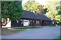
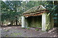
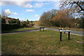
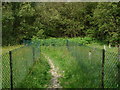
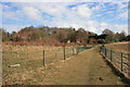
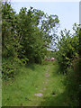
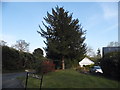
35 photos from this area
Area Information
Key information about the GU22 0PU including its size, population, and administrative classification.
- Area Type
- Postcode
- Area Size
- 5.5 hectares
- Population
- 1361
- Population Density
- 1200 people/km²
House Prices in GU22 0PU
25
Properties
£629,600
Average Sold Price
£172,000
Lowest Price
£1,050,000
Highest Price
Showing 25 properties
| Address | Type | Beds | Baths | Last Sale Price | Last Sale Date | |
|---|---|---|---|---|---|---|
| Maristow, 24 Ridge Close, Woking, GU22 0PU | Detached | 4 | 1 | £925,000 | Jan 2025 | |
| Spindrift, Ridge Close, Woking, GU22 0PU | house | - | - | £870,000 | Sep 2021 | |
| Lanson House, Ridge Close, Woking, GU22 0PU | Detached | 4 | 3 | £925,000 | Nov 2020 | |
| Tau Lodge, 26 Ridge Close, Woking, GU22 0PU | house | - | - | £1,050,000 | May 2020 | |
| Antibes, 14 Ridge Close, Woking, GU22 0PU | Detached | 4 | 1 | £817,500 | Dec 2019 | |
| Ashstead, Ridge Close, Woking, GU22 0PU | Detached | 5 | 2 | £920,000 | Aug 2019 | |
| Penhill, 9 Ridge Close, Woking, GU22 0PU | house | - | - | £650,000 | Mar 2012 | |
| Woodlands, 18 Ridge Close, Woking, GU22 0PU | Detached | - | - | £592,500 | Feb 2008 | |
| Alameda, 19 Ridge Close, Woking, GU22 0PU | Detached | - | - | £568,700 | Aug 2006 | |
| Pendle, 27 Ridge Close, Woking, GU22 0PU | Detached | - | - | £499,950 | Aug 2002 |
Page 1 of 3
Energy Efficiency in GU22 0PU
Amenities
Schools
| Rank | School | Type | Entry gender | Ages |
|---|
Explore more schools in this area
Go to Schools tabDemographics
Household Size
Family (3-5 people)
most common
Accommodation Type
Houses
most common
Tenure
92
majority
Ethnic Group
White
most common
Religion
N/A
most common
Household Composition
N/A
most common
Age
47
median
Adults (30-64 years)
most common
Household Deprivation
N/A
with no deprivation
NS-SEC
61
in Lower managerial occupations
Explore more demographic insights in this area
Go to Demographics tabPlanning
Planning Constraints
- Flood RiskPremium
- Ramsar Wetland SitesPremium
- Area of Outstanding Natural BeautyPremium
- Protected Nature ReservePremium
- Protected WoodlandPremium