Area Overview for GU22 0DP
Photos of GU22 0DP

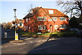
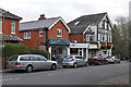


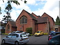

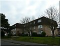
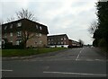
44 photos from this area
Area Information
Key information about the GU22 0DP including its size, population, and administrative classification.
- Area Type
- Postcode
- Area Size
- 2.4 hectares
- Population
- 1361
- Population Density
- 1200 people/km²
House Prices in GU22 0DP
20
Properties
£704,233
Average Sold Price
£210,000
Lowest Price
£1,737,500
Highest Price
Showing 20 properties
| Address | Type | Beds | Baths | Last Sale Price | Last Sale Date | |
|---|---|---|---|---|---|---|
| Blendworth, Hook Heath Road, Woking, GU22 0DP | Semi-detached | 5 | 3 | £369,686 | Oct 2024 | |
| Rough Lea, Hook Heath Road, Woking, GU22 0DP | Retail | 5 | 2 | £925,000 | May 2022 | |
| Cotteridge, Hook Heath Road, Woking, GU22 0DP | Detached | 5 | 3 | £1,737,500 | Sep 2021 | |
| The Chesils, Hook Heath Road, Woking, GU22 0DP | Detached | 4 | - | £780,000 | Mar 2021 | |
| Court Bungalow, Hook Heath Road, Woking, GU22 0DP | Bungalow | 4 | 2 | £750,000 | Jun 2020 | |
| Little Morton, Hook Heath Road, Woking, GU22 0DP | Detached | 6 | 2 | £927,315 | May 2018 | |
| Little Gables, Hook Heath Road, Woking, GU22 0DP | Semi-detached | 4 | 2 | £600,000 | Aug 2012 | |
| Ridgeway, Hook Heath Road, Woking, GU22 0DP | Semi-detached | - | - | £635,000 | Jul 2010 | |
| Ingleside, Hook Heath Road, Woking, GU22 0DP | house | - | - | £400,000 | Jun 2010 | |
| Fairview, Hook Heath Road, Woking, GU22 0DP | Detached | 4 | 2 | £758,000 | Oct 2007 |
Page 1 of 2
Energy Efficiency in GU22 0DP
Amenities
Schools
| Rank | School | Type | Entry gender | Ages |
|---|
Explore more schools in this area
Go to Schools tabDemographics
Household Size
Family (3-5 people)
most common
Accommodation Type
Houses
most common
Tenure
92
majority
Ethnic Group
White
most common
Religion
N/A
most common
Household Composition
N/A
most common
Age
47
median
Adults (30-64 years)
most common
Household Deprivation
N/A
with no deprivation
NS-SEC
61
in Lower managerial occupations
Explore more demographic insights in this area
Go to Demographics tabPlanning
Planning Constraints
- Flood RiskPremium
- Ramsar Wetland SitesPremium
- Area of Outstanding Natural BeautyPremium
- Protected Nature ReservePremium
- Protected WoodlandPremium