Area Overview for GU22 0AY
Photos of GU22 0AY
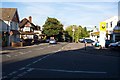
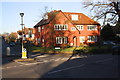
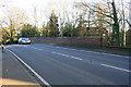
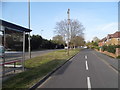
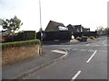
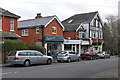
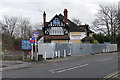
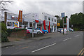
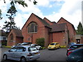
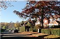
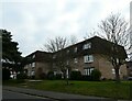
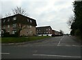
44 photos from this area
Area Information
Key information about the GU22 0AY including its size, population, and administrative classification.
- Area Type
- Postcode
- Area Size
- 1.4 hectares
- Population
- 2464
- Population Density
- 3613 people/km²
House Prices in GU22 0AY
26
Properties
£530,200
Average Sold Price
£139,000
Lowest Price
£1,140,000
Highest Price
Showing 26 properties
| Address | Type | Beds | Baths | Last Sale Price | Last Sale Date | |
|---|---|---|---|---|---|---|
| 63 Egley Road, Woking, GU22 0AY | Detached | 4 | 2 | £950,000 | Mar 2025 | |
| 39 Egley Road, Woking, GU22 0AY | Detached | 4 | 2 | £775,000 | Nov 2024 | |
| 57 Egley Road, Woking, GU22 0AY | Detached | 4 | 4 | £1,140,000 | May 2024 | |
| 65 Egley Road, Woking, GU22 0AY | Detached | 4 | 1 | £900,000 | Nov 2022 | |
| Ockley House, 33 Egley Road, Woking, GU22 0AY | Detached | 3 | 1 | £575,000 | Mar 2019 | |
| 67 Egley Road, Woking, GU22 0AY | Detached | 5 | 3 | £705,000 | Jul 2018 | |
| Roy-tor, 55 Egley Road, Woking, GU22 0AY | house | 3 | 1 | £572,000 | Oct 2016 | |
| Trenowen, 41 Egley Road, Woking, GU22 0AY | Detached | 4 | - | £452,250 | Dec 2013 | |
| 69 Egley Road, Woking, GU22 0AY | Detached | 5 | 3 | £550,000 | May 2012 | |
| 49 Egley Road, Woking, GU22 0AY | house | 4 | - | £455,000 | Aug 2011 |
Page 1 of 3
Energy Efficiency in GU22 0AY
Amenities
Schools
| Rank | School | Type | Entry gender | Ages |
|---|
Explore more schools in this area
Go to Schools tabDemographics
Household Size
Family (3-5 people)
most common
Accommodation Type
Houses
most common
Tenure
65
majority
Ethnic Group
White
most common
Religion
N/A
most common
Household Composition
N/A
most common
Age
47
median
Adults (30-64 years)
most common
Household Deprivation
N/A
with no deprivation
NS-SEC
39
in Lower managerial occupations
Explore more demographic insights in this area
Go to Demographics tabPlanning
Planning Constraints
- Flood RiskPremium
- Ramsar Wetland SitesPremium
- Area of Outstanding Natural BeautyPremium
- Protected Nature ReservePremium
- Protected WoodlandPremium