Area Overview for GU22 0AF
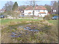
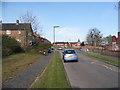
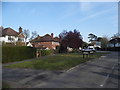
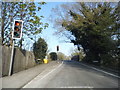
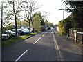
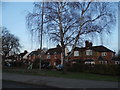
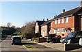
Photos of GU22 0AF


Area Information
GU22 0AF is a compact residential cluster in England, spanning 4.2 hectares and home to 1,040 residents. Its population density of 724 people per square kilometre suggests a closely knit community, where daily life is shaped by proximity to amenities and a strong focus on home ownership. The area is characterised by its predominantly single-family homes, with 93% of properties owner-occupied, reflecting a stable, long-term resident base. The median age of 47 indicates a mature demographic, with the majority of residents aged 30–64, creating a balance between established families and professionals. Nearby, the outstanding-rated Hoe Valley School offers a high standard of education, while practical access to rail stations like Worplesdon and Brookwood ensures connectivity to nearby towns. The area’s small size means residents benefit from a tight-knit environment, with local shops such as Co-op Woking and Morrisons Daily within walking distance. For those seeking a blend of convenience and tranquillity, GU22 0AF provides a self-contained yet accessible living experience, with minimal environmental constraints and a low crime risk.
- Area Type
- Postcode
- Area Size
- 4.2 hectares
- Population
- 1040
- Population Density
- 724 people/km²
GU22 0AF is a predominantly owner-occupied area, with 93% of properties in private hands. The housing stock is exclusively composed of houses, which is unusual in regions with more varied accommodation types. This suggests a market skewed towards family homes rather than rental properties, potentially limiting options for buyers seeking flats or apartments. The small area size of 4.2 hectares means the housing stock is compact, with properties likely to be spaced apart. For buyers, this presents a challenge in terms of availability but also ensures a quiet, residential character. The high home ownership rate indicates a stable market, with little turnover. Given the proximity to rail stations and schools, the area appeals to those prioritising convenience and safety. However, the limited size of the area means buyers should consider nearby neighbourhoods for a broader selection of properties.
House Prices in GU22 0AF
Showing 1 properties
| Address | Type | Beds | Baths | Last Sale Price | Last Sale Date | |
|---|---|---|---|---|---|---|
| Virtuoso Services Ltd, Catering Service On Hoe Valley School Construction Site, Egley Road, Woking, GU22 0AF | Restaurant | - | - | - | - |
Energy Efficiency in GU22 0AF
Residents of GU22 0AF have access to a range of local amenities within practical reach. The area includes five retail outlets, such as Co-op Woking and Morrisons Daily, providing essential shopping options. Rail stations like Worplesdon and Brookwood offer easy access to nearby towns, while Fairoaks Airport is a short distance away, facilitating travel. Although the data does not specify parks or leisure facilities, the presence of multiple retail and transport options suggests a convenient lifestyle. The compact nature of the area means amenities are closely clustered, reducing the need for long commutes. For those valuing accessibility, the combination of local shops, rail links, and an airport ensures a balance between convenience and connectivity. The area’s small size fosters a community feel, with residents likely to interact regularly at local stores and transport hubs.
Amenities
Schools
The nearest school to GU22 0AF is Hoe Valley School, an academy with an outstanding Ofsted rating. This designation highlights its excellence in education, offering families a high standard of teaching and facilities. As an academy, it operates independently of local authority control, which can lead to greater autonomy in curriculum and resource allocation. The presence of a single outstanding school in the immediate vicinity is a significant draw for families, though it is worth noting that the area does not list additional schools. This concentration of educational provision may be sufficient for some households but could necessitate travel for those seeking alternative options. The school’s rating underscores the area’s appeal for families prioritising quality education.
| Rank | School | Type | Entry gender | Ages |
|---|
Explore more schools in this area
Go to Schools tabDemographics
The population of GU22 0AF is 1,040, with a median age of 47 and the largest age group being adults aged 30–64. This suggests a community rooted in stability, with many residents likely to be in their prime working years or raising families. Home ownership is exceptionally high at 93%, indicating a preference for long-term residency over rental properties. The area is composed entirely of houses, reflecting a traditional housing stock that contrasts with higher-density developments. The predominant ethnic group is White, which aligns with broader trends in the region. The population density of 724 people per square kilometre implies a mix of household types, though the data does not specify the exact distribution. The high home ownership rate and mature age profile suggest a community with strong local ties and a focus on family-oriented living.
Household Size
Accommodation Type
Tenure
Ethnic Group
Religion
Household Composition
Age
Household Deprivation
NS-SEC
Explore more demographic insights in this area
Go to Demographics tabPlanning
Planning Constraints
- Flood RiskPremium
- Ramsar Wetland SitesPremium
- Area of Outstanding Natural BeautyPremium
- Protected Nature ReservePremium
- Protected WoodlandPremium