Area Overview for GU21 8XL
Photos of GU21 8XL
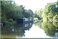


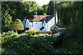


45 photos from this area
Area Information
Key information about the GU21 8XL including its size, population, and administrative classification.
- Area Type
- Postcode
- Area Size
- 1.7 hectares
- Population
- 1936
- Population Density
- 3913 people/km²
House Prices in GU21 8XL
15
Properties
£535,829
Average Sold Price
£130,000
Lowest Price
£935,000
Highest Price
Showing 15 properties
| Address | Type | Beds | Baths | Last Sale Price | Last Sale Date | |
|---|---|---|---|---|---|---|
| 9 Elmgrove Close, Knaphill, Woking, GU21 8XL | Detached | 3 | 1 | £670,500 | Feb 2024 | |
| 14 Elmgrove Close, Knaphill, Woking, GU21 8XL | Detached | 4 | 2 | £935,000 | Jun 2023 | |
| 11 Elmgrove Close, Knaphill, Woking, GU21 8XL | house | 3 | 1 | £648,000 | Aug 2022 | |
| 6 Elmgrove Close, Knaphill, Woking, GU21 8XL | Detached | 4 | 1 | £642,000 | Jun 2022 | |
| 3 Elmgrove Close, Knaphill, Woking, GU21 8XL | Detached | 3 | - | £665,000 | Aug 2021 | |
| 1 Elmgrove Close, Knaphill, Woking, GU21 8XL | house | - | - | £535,000 | Feb 2021 | |
| 10 Elmgrove Close, Knaphill, Woking, GU21 8XL | Detached | 4 | 2 | £635,000 | Sep 2019 | |
| 2 Elmgrove Close, Knaphill, Woking, GU21 8XL | Detached | 4 | - | £480,000 | Apr 2014 | |
| 4 Elmgrove Close, Knaphill, Woking, GU21 8XL | house | 3 | - | £387,500 | Mar 2010 | |
| 7 Elmgrove Close, Knaphill, Woking, GU21 8XL | Detached | 3 | 1 | £355,000 | Jun 2005 |
Page 1 of 2
Energy Efficiency in GU21 8XL
Amenities
Schools
| Rank | School | Type | Entry gender | Ages |
|---|
Explore more schools in this area
Go to Schools tabDemographics
Household Size
Family (3-5 people)
most common
Accommodation Type
Houses
most common
Tenure
90
majority
Ethnic Group
White
most common
Religion
N/A
most common
Household Composition
N/A
most common
Age
47
median
Adults (30-64 years)
most common
Household Deprivation
N/A
with no deprivation
NS-SEC
44
in Lower managerial occupations
Explore more demographic insights in this area
Go to Demographics tabPlanning
Planning Constraints
- Flood RiskPremium
- Ramsar Wetland SitesPremium
- Area of Outstanding Natural BeautyPremium
- Protected Nature ReservePremium
- Protected WoodlandPremium