Area Overview for GU21 7XN
Photos of GU21 7XN
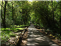
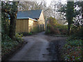
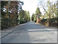
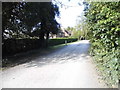
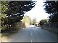
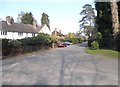
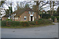

66 photos from this area
Area Information
Key information about the GU21 7XN including its size, population, and administrative classification.
- Area Type
- Postcode
- Area Size
- 1892 m²
- Population
- 1494
- Population Density
- 855 people/km²
House Prices in GU21 7XN
21
Properties
£173,703
Average Sold Price
£65,350
Lowest Price
£240,000
Highest Price
Showing 21 properties
| Address | Type | Beds | Baths | Last Sale Price | Last Sale Date | |
|---|---|---|---|---|---|---|
| 7 St Johns Mews, St Johns, Woking, GU21 7XN | Flat | - | - | £222,500 | Apr 2023 | |
| 17 St Johns Mews, St Johns, Woking, GU21 7XN | Flat | 1 | 1 | £195,000 | Feb 2023 | |
| 2 St Johns Mews, St Johns, Woking, GU21 7XN | Maisonette | 1 | 1 | £218,000 | Nov 2022 | |
| 6 St Johns Mews, St Johns, Woking, GU21 7XN | Flat | 1 | 1 | £228,000 | Nov 2022 | |
| 4 St Johns Mews, St Johns, Woking, GU21 7XN | Flat | 1 | 1 | £240,000 | Aug 2022 | |
| 13 St Johns Mews, St Johns, Woking, GU21 7XN | Maisonette | 1 | 1 | £220,000 | Sep 2019 | |
| 12 St Johns Mews, St Johns, Woking, GU21 7XN | Flat | - | - | £150,000 | Aug 2019 | |
| 5 St Johns Mews, St Johns, Woking, GU21 7XN | Flat | 1 | - | £219,500 | Sep 2017 | |
| 10 St Johns Mews, St Johns, Woking, GU21 7XN | Maisonette | 1 | 1 | £189,950 | Dec 2014 | |
| 14 St Johns Mews, St Johns, Woking, GU21 7XN | Maisonette | - | - | £132,000 | May 2008 |
Page 1 of 3
Energy Efficiency in GU21 7XN
Amenities
Schools
| Rank | School | Type | Entry gender | Ages |
|---|
Explore more schools in this area
Go to Schools tabDemographics
Household Size
Two person
most common
Accommodation Type
Houses
most common
Tenure
78
majority
Ethnic Group
White
most common
Religion
N/A
most common
Household Composition
N/A
most common
Age
47
median
Adults (30-64 years)
most common
Household Deprivation
N/A
with no deprivation
NS-SEC
53
in Lower managerial occupations
Explore more demographic insights in this area
Go to Demographics tabPlanning
Planning Constraints
- Flood RiskPremium
- Ramsar Wetland SitesPremium
- Area of Outstanding Natural BeautyPremium
- Protected Nature ReservePremium
- Protected WoodlandPremium