Area Overview for GU21 6NT
Photos of GU21 6NT
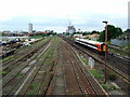
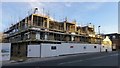

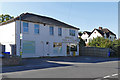
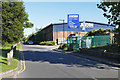
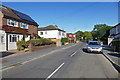


61 photos from this area
Area Information
Key information about the GU21 6NT including its size, population, and administrative classification.
- Area Type
- Postcode
- Area Size
- 2.1 hectares
- Population
- 2423
- Population Density
- 3769 people/km²
House Prices in GU21 6NT
35
Properties
£384,814
Average Sold Price
£112,000
Lowest Price
£800,000
Highest Price
Showing 35 properties
| Address | Type | Beds | Baths | Last Sale Price | Last Sale Date | |
|---|---|---|---|---|---|---|
| 70 Kingsway, Woking, GU21 6NT | Terraced | 3 | 1 | £575,000 | Aug 2025 | |
| 34 Kingsway, Woking, GU21 6NT | Semi-detached | 3 | 2 | £617,000 | Dec 2023 | |
| 33 Kingsway, Woking, GU21 6NT | house | - | - | £660,000 | Aug 2021 | |
| 28 Kingsway, Woking, GU21 6NT | house | - | - | £800,000 | Apr 2021 | |
| 37 Kingsway, Woking, GU21 6NT | house | - | - | £565,000 | Mar 2021 | |
| 31 Kingsway, Woking, GU21 6NT | Detached | 3 | 1 | £580,000 | Nov 2018 | |
| 29 Kingsway, Woking, GU21 6NT | Detached | 4 | - | £737,000 | May 2017 | |
| 42 Kingsway, Woking, GU21 6NT | Semi-detached | 4 | - | £616,000 | Nov 2014 | |
| 25A Kingsway, Woking, GU21 6NT | Maisonette | - | - | £235,000 | Jan 2014 | |
| 60 Kingsway, Woking, GU21 6NT | Semi-detached | 4 | 2 | £380,000 | Jul 2013 |
Page 1 of 4
Energy Efficiency in GU21 6NT
Amenities
Schools
| Rank | School | Type | Entry gender | Ages |
|---|
Explore more schools in this area
Go to Schools tabDemographics
Household Size
One person
most common
Accommodation Type
Flats
most common
Tenure
43
majority
Ethnic Group
White
most common
Religion
N/A
most common
Household Composition
N/A
most common
Age
47
median
Adults (30-64 years)
most common
Household Deprivation
N/A
with no deprivation
NS-SEC
48
in Lower managerial occupations
Explore more demographic insights in this area
Go to Demographics tabPlanning
Planning Constraints
- Flood RiskPremium
- Ramsar Wetland SitesPremium
- Area of Outstanding Natural BeautyPremium
- Protected Nature ReservePremium
- Protected WoodlandPremium