Area Overview for GU21 4TD
Photos of GU21 4TD
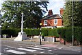
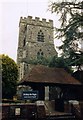
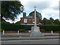


44 photos from this area
Area Information
Key information about the GU21 4TD including its size, population, and administrative classification.
- Area Type
- Postcode
- Area Size
- 1.3 hectares
- Population
- 1432
- Population Density
- 3802 people/km²
House Prices in GU21 4TD
38
Properties
£386,695
Average Sold Price
£72,000
Lowest Price
£714,100
Highest Price
Showing 38 properties
| Address | Type | Beds | Baths | Last Sale Price | Last Sale Date | |
|---|---|---|---|---|---|---|
| 52 Meadway Drive, Horsell, Woking, GU21 4TD | Semi-detached | 4 | 2 | £575,000 | Aug 2025 | |
| 53 Meadway Drive, Horsell, Woking, GU21 4TD | house | - | - | £550,000 | Mar 2025 | |
| 28 Meadway Drive, Horsell, Woking, GU21 4TD | Semi-detached | 3 | 2 | £714,100 | Sep 2024 | |
| 46 Meadway Drive, Horsell, Woking, GU21 4TD | Semi-detached | 3 | 1 | £687,000 | Sep 2023 | |
| 43 Meadway Drive, Horsell, Woking, GU21 4TD | Semi-detached | 3 | 2 | £624,000 | Sep 2023 | |
| 41 Meadway Drive, Horsell, Woking, GU21 4TD | Semi-detached | 3 | 1 | £517,000 | Apr 2023 | |
| 32 Meadway Drive, Horsell, Woking, GU21 4TD | house | 3 | - | £500,000 | Oct 2019 | |
| 42 Meadway Drive, Horsell, Woking, GU21 4TD | Semi-detached | 3 | 1 | £540,000 | Jun 2019 | |
| 38 Meadway Drive, Horsell, Woking, GU21 4TD | Semi-detached | 3 | 1 | £489,950 | Feb 2019 | |
| 58 Meadway Drive, Horsell, Woking, GU21 4TD | Semi-detached | 4 | 1 | £573,000 | Oct 2018 |
Page 1 of 4
Energy Efficiency in GU21 4TD
Amenities
Schools
| Rank | School | Type | Entry gender | Ages |
|---|
Explore more schools in this area
Go to Schools tabDemographics
Household Size
Family (3-5 people)
most common
Accommodation Type
Houses
most common
Tenure
84
majority
Ethnic Group
White
most common
Religion
N/A
most common
Household Composition
N/A
most common
Age
47
median
Adults (30-64 years)
most common
Household Deprivation
N/A
with no deprivation
NS-SEC
52
in Lower managerial occupations
Explore more demographic insights in this area
Go to Demographics tabPlanning
Planning Constraints
- Flood RiskPremium
- Ramsar Wetland SitesPremium
- Area of Outstanding Natural BeautyPremium
- Protected Nature ReservePremium
- Protected WoodlandPremium