Area Overview for GU21 4NR
Photos of GU21 4NR
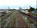
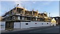
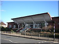
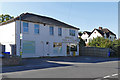
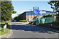

61 photos from this area
Area Information
Key information about the GU21 4NR including its size, population, and administrative classification.
- Area Type
- Postcode
- Area Size
- 4557 m²
- Population
- 1453
- Population Density
- 5479 people/km²
House Prices in GU21 4NR
12
Properties
£417,780
Average Sold Price
£187,000
Lowest Price
£790,000
Highest Price
Showing 12 properties
| Address | Type | Beds | Baths | Last Sale Price | Last Sale Date | |
|---|---|---|---|---|---|---|
| 86 Arthurs Bridge Road, Woking, GU21 4NR | Flat | 1 | 1 | £200,000 | Feb 2025 | |
| 84 Arthurs Bridge Road, Woking, GU21 4NR | Detached | 3 | 1 | £790,000 | Jan 2025 | |
| 78 Arthurs Bridge Road, Woking, GU21 4NR | Semi-detached | 3 | 1 | £612,500 | Nov 2024 | |
| 74 Arthurs Bridge Road, Woking, GU21 4NR | Semi-detached | 3 | 2 | £623,000 | Oct 2020 | |
| 80 Arthurs Bridge Road, Woking, GU21 4NR | Detached | 3 | 1 | £540,000 | Dec 2018 | |
| 86A Arthurs Bridge Road, Woking, GU21 4NR | Maisonette | - | - | £232,571 | Nov 2015 | |
| 88A Arthurs Bridge Road, Woking, GU21 4NR | Flat | - | - | £187,000 | Jul 2012 | |
| Willow End, 90 Arthurs Bridge Road, Woking, GU21 4NR | Detached | - | - | £325,000 | Sep 2004 | |
| 72 Arthurs Bridge Road, Woking, GU21 4NR | Semi-detached | - | - | £249,950 | Dec 2003 | |
| 76 Arthurs Bridge Road, Woking, GU21 4NR | Semi-detached | 3 | 1 | - | - |
Page 1 of 2
Energy Efficiency in GU21 4NR
Amenities
Schools
| Rank | School | Type | Entry gender | Ages |
|---|
Explore more schools in this area
Go to Schools tabDemographics
Household Size
Family (3-5 people)
most common
Accommodation Type
Houses
most common
Tenure
61
majority
Ethnic Group
White
most common
Religion
N/A
most common
Household Composition
N/A
most common
Age
47
median
Adults (30-64 years)
most common
Household Deprivation
N/A
with no deprivation
NS-SEC
46
in Lower managerial occupations
Explore more demographic insights in this area
Go to Demographics tabPlanning
Planning Constraints
- Flood RiskPremium
- Ramsar Wetland SitesPremium
- Area of Outstanding Natural BeautyPremium
- Protected Nature ReservePremium
- Protected WoodlandPremium