Area Overview for GU21 4NA
Photos of GU21 4NA


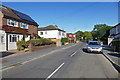
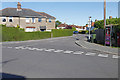


61 photos from this area
Area Information
Key information about the GU21 4NA including its size, population, and administrative classification.
- Area Type
- Postcode
- Area Size
- 2.0 hectares
- Population
- 1488
- Population Density
- 4098 people/km²
House Prices in GU21 4NA
18
Properties
£638,866
Average Sold Price
£191,000
Lowest Price
£1,110,000
Highest Price
Showing 18 properties
| Address | Type | Beds | Baths | Last Sale Price | Last Sale Date | |
|---|---|---|---|---|---|---|
| 24 Brewery Road, Horsell, Woking, GU21 4NA | Semi-detached | 4 | 2 | £795,000 | Jul 2023 | |
| 44 Brewery Road, Horsell, Woking, GU21 4NA | Retail | 5 | 3 | £1,110,000 | Oct 2022 | |
| 22 Brewery Road, Horsell, Woking, GU21 4NA | Semi-detached | 3 | 1 | £645,000 | Jul 2022 | |
| 20 Brewery Road, Horsell, Woking, GU21 4NA | Detached | 3 | 2 | £790,000 | Sep 2021 | |
| 48A Brewery Road, Horsell, Woking, GU21 4NA | house | 1 | 1 | £462,500 | Jun 2021 | |
| 36 Brewery Road, Horsell, Woking, GU21 4NA | Detached | 4 | 2 | £860,000 | Mar 2021 | |
| 42 Brewery Road, Horsell, Woking, GU21 4NA | Bungalow | 4 | 2 | £740,000 | Jul 2019 | |
| 40 Brewery Road, Horsell, Woking, GU21 4NA | Detached | 4 | - | £930,000 | Nov 2016 | |
| 46 Brewery Road, Horsell, Woking, GU21 4NA | Detached | 1 | - | £659,393 | Apr 2014 | |
| 48 Brewery Road, Horsell, Woking, GU21 4NA | house | 2 | - | £213,500 | Jan 2003 |
Page 1 of 2
Energy Efficiency in GU21 4NA
Amenities
Schools
| Rank | School | Type | Entry gender | Ages |
|---|
Explore more schools in this area
Go to Schools tabDemographics
Household Size
Family (3-5 people)
most common
Accommodation Type
Houses
most common
Tenure
86
majority
Ethnic Group
White
most common
Religion
N/A
most common
Household Composition
N/A
most common
Age
47
median
Adults (30-64 years)
most common
Household Deprivation
N/A
with no deprivation
NS-SEC
59
in Lower managerial occupations
Explore more demographic insights in this area
Go to Demographics tabPlanning
Planning Constraints
- Flood RiskPremium
- Ramsar Wetland SitesPremium
- Area of Outstanding Natural BeautyPremium
- Protected Nature ReservePremium
- Protected WoodlandPremium