Area Overview for GU21 4JA
Photos of GU21 4JA
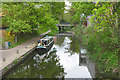
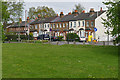
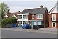
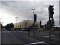
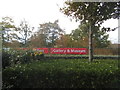
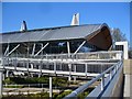
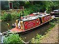
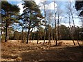
93 photos from this area
Area Information
Key information about the GU21 4JA including its size, population, and administrative classification.
- Area Type
- Postcode
- Area Size
- 2.1 hectares
- Population
- 1507
- Population Density
- 1374 people/km²
House Prices in GU21 4JA
13
Properties
£1,204,417
Average Sold Price
£780,000
Lowest Price
£1,750,000
Highest Price
Showing 13 properties
| Address | Type | Beds | Baths | Last Sale Price | Last Sale Date | |
|---|---|---|---|---|---|---|
| Horsell Grange House, Kettlewell Hill, Horsell, Woking, GU21 4JA | Detached | 5 | 2 | £1,430,000 | Oct 2023 | |
| Evergreen Lodge, Kettlewell Hill, Horsell, Woking, GU21 4JA | Detached | 4 | 2 | £1,065,000 | May 2023 | |
| Alstin Lodge, Kettlewell Hill, Horsell, Woking, GU21 4JA | house | - | - | £1,326,500 | Jun 2021 | |
| Horsell Lodge Residential Care Home, Kettlewell Hill, Horsell, Woking, GU21 4JA | Retirement | - | - | £1,750,000 | Dec 2015 | |
| Little Garth, Kettlewell Hill, Horsell, Woking, GU21 4JA | Detached | 6 | 2 | £875,000 | Jun 2014 | |
| Old Orchard, Kettlewell Hill, Horsell, Woking, GU21 4JA | Detached | 6 | 3 | £780,000 | Jan 2007 | |
| 2, Grange Mews, Kettlewell Hill, Horsell, Woking, GU21 4JA | Terraced | 4 | 3 | - | - | |
| 1, Grange Mews, Kettlewell Hill, Horsell, Woking, GU21 4JA | Terraced | 4 | 3 | - | - | |
| 2, Horsell Grange, Kettlewell Hill, Horsell, Woking, GU21 4JA | Terraced | 4 | 3 | - | - | |
| 1, Horsell Grange, Kettlewell Hill, Horsell, Woking, GU21 4JA | Semi-detached | - | - | - | - |
Page 1 of 2
Energy Efficiency in GU21 4JA
Amenities
Schools
| Rank | School | Type | Entry gender | Ages |
|---|
Explore more schools in this area
Go to Schools tabDemographics
Household Size
Family (3-5 people)
most common
Accommodation Type
Houses
most common
Tenure
91
majority
Ethnic Group
White
most common
Religion
N/A
most common
Household Composition
N/A
most common
Age
47
median
Adults (30-64 years)
most common
Household Deprivation
N/A
with no deprivation
NS-SEC
60
in Lower managerial occupations
Explore more demographic insights in this area
Go to Demographics tabPlanning
Planning Constraints
- Flood RiskPremium
- Ramsar Wetland SitesPremium
- Area of Outstanding Natural BeautyPremium
- Protected Nature ReservePremium
- Protected WoodlandPremium