Area Overview for GU21 4HF
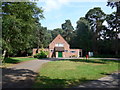
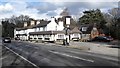
Photos of GU21 4HF


Area Information
GU21 4HF is a small residential postcode area in England, home to 1,767 people living at a density of 1,053 per square kilometre. This compact cluster of homes reflects a tight-knit community, where daily life is shaped by proximity to local amenities and transport links. The area’s character is defined by its mix of private residences and practical infrastructure, catering to a population skewed toward middle-aged adults. With no major natural or protected sites nearby, the focus here is on everyday living—shopping, commuting, and family needs. The presence of multiple rail stations and retail hubs within reach suggests a balance between suburban comfort and accessibility. For those considering living here, the area offers a snapshot of typical English residential life: modest in scale, yet connected to broader networks. Its small size means the community feels cohesive, with residents likely to know their neighbours. While not a tourist destination, GU21 4HF is a functional, low-risk postcode for those prioritising stability and practicality.
- Area Type
- Postcode
- Area Size
- Not available
- Population
- 1767
- Population Density
- 1053 people/km²
GU21 4HF is a predominantly owner-occupied area, with 64% of homes owned by residents rather than rented. The accommodation type is largely houses, which is unusual for a small postcode but suggests a focus on family-sized properties. This mix of ownership and housing stock indicates a market where long-term residents are likely to hold their homes, creating a stable environment for buyers. The limited size of the area means the housing stock is finite, but the presence of multiple rail stations nearby may make it attractive to commuters. For buyers, this could mean fewer properties available but potentially higher demand from those seeking a low-risk, established neighbourhood. The lack of rental properties also suggests a community prioritising permanence over transient living.
House Prices in GU21 4HF
No properties found in this postcode.
Energy Efficiency in GU21 4HF
GU21 4HF offers a range of amenities within practical reach. Retail options include Asda Woking, Aldi Woking, and other stores, providing convenience for daily shopping. The area’s proximity to Fairoaks Airport and multiple ferry landings adds to its connectivity, while rail stations like West Byfleet and Byfleet & New Haw link to broader networks. Though the data does not specify parks or leisure venues, the presence of retail and transport hubs suggests a lifestyle focused on practicality and accessibility. The mix of shopping, transport, and travel options makes daily life efficient, with minimal need to travel far for essentials.
Amenities
Schools
The nearest school to GU21 4HF is Halstead Preparatory School, an independent institution. No other schools are listed in the data, so families relying on state education may need to look beyond the immediate area. The presence of an independent school suggests the area may attract households prioritising private education, though it does not indicate the quality of state schools nearby. For those valuing independent schooling, Halstead offers a dedicated option, but the absence of additional schools highlights the need for research into broader educational networks.
| Rank | School | Type | Entry gender | Ages |
|---|
Explore more schools in this area
Go to Schools tabDemographics
The population of GU21 4HF is predominantly adults aged 30–64, with a median age of 47. This suggests a mature, established community, likely with a high proportion of families and long-term residents. Home ownership stands at 64%, indicating a mix of owner-occupied properties and rental units. The accommodation type is primarily houses, which aligns with the demographic profile of older, settled households. The predominant ethnic group is White, reflecting the broader regional composition. While no specific deprivation data is provided, the high home ownership rate and low crime score suggest a relatively stable socioeconomic environment. The absence of significant age groups under 18 or over 65 implies a community focused on middle years, possibly with fewer childcare or retirement-related pressures. This profile may appeal to professionals or couples seeking a quiet, low-maintenance lifestyle.
Household Size
Accommodation Type
Tenure
Ethnic Group
Religion
Household Composition
Age
Household Deprivation
NS-SEC
Explore more demographic insights in this area
Go to Demographics tabPlanning
Planning Constraints
- Flood RiskPremium
- Ramsar Wetland SitesPremium
- Area of Outstanding Natural BeautyPremium
- Protected Nature ReservePremium
- Protected WoodlandPremium