Area Overview for GU21 4ES
Photos of GU21 4ES
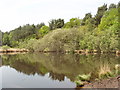

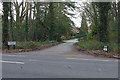
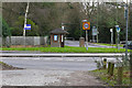
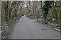
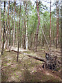
37 photos from this area
Area Information
Key information about the GU21 4ES including its size, population, and administrative classification.
- Area Type
- Postcode
- Area Size
- 1.3 hectares
- Population
- 1767
- Population Density
- 1053 people/km²
House Prices in GU21 4ES
11
Properties
£758,595
Average Sold Price
£146,666
Lowest Price
£1,466,000
Highest Price
Showing 11 properties
| Address | Type | Beds | Baths | Last Sale Price | Last Sale Date | |
|---|---|---|---|---|---|---|
| Ceris, Castle Road, Horsell, Woking, GU21 4ES | Detached | 4 | 2 | £1,010,000 | Jul 2025 | |
| Rollings, Castle Road, Horsell, Woking, GU21 4ES | Detached | 4 | 3 | £980,000 | Feb 2023 | |
| Heathers, Castle Road, Horsell, Woking, GU21 4ES | Detached | 4 | 2 | £1,466,000 | Dec 2022 | |
| 24 Castle Road, Horsell, Woking, GU21 4ES | house | 4 | - | £950,000 | Dec 2020 | |
| Sequoia, Castle Road, Horsell, Woking, GU21 4ES | Detached | - | - | £580,000 | Mar 2005 | |
| The Little Orchard, Castle Road, Horsell, Woking, GU21 4ES | Detached | - | - | £146,666 | Aug 1999 | |
| Windrush, Castle Road, Horsell, Woking, GU21 4ES | Detached | - | - | £177,500 | Dec 1996 | |
| Ottermead, Castle Road, Horsell, Woking, GU21 4ES | Terraced | - | - | - | - | |
| Avalon, Castle Road, Horsell, Woking, GU21 4ES | Detached | - | - | - | - | |
| Whiteacre, Castle Road, Horsell, Woking, GU21 4ES | Detached | - | - | - | - |
Page 1 of 2
Energy Efficiency in GU21 4ES
Amenities
Schools
| Rank | School | Type | Entry gender | Ages |
|---|
Explore more schools in this area
Go to Schools tabDemographics
Household Size
Two person
most common
Accommodation Type
Houses
most common
Tenure
64
majority
Ethnic Group
White
most common
Religion
N/A
most common
Household Composition
N/A
most common
Age
47
median
Adults (30-64 years)
most common
Household Deprivation
N/A
with no deprivation
NS-SEC
57
in Lower managerial occupations
Explore more demographic insights in this area
Go to Demographics tabPlanning
Planning Constraints
- Flood RiskPremium
- Ramsar Wetland SitesPremium
- Area of Outstanding Natural BeautyPremium
- Protected Nature ReservePremium
- Protected WoodlandPremium