Area Overview for GU21 2PL
Photos of GU21 2PL
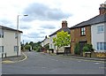

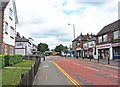
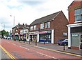
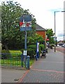
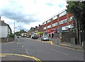
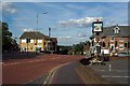
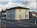
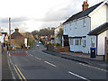
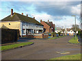
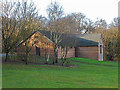
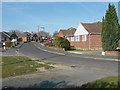
65 photos from this area
Area Information
Key information about the GU21 2PL including its size, population, and administrative classification.
- Area Type
- Postcode
- Area Size
- 1.5 hectares
- Population
- 1776
- Population Density
- 3442 people/km²
House Prices in GU21 2PL
18
Properties
£363,854
Average Sold Price
£124,950
Lowest Price
£770,000
Highest Price
Showing 18 properties
| Address | Type | Beds | Baths | Last Sale Price | Last Sale Date | |
|---|---|---|---|---|---|---|
| 4 Shirley Place, Knaphill, Woking, GU21 2PL | house | - | - | £485,000 | Apr 2021 | |
| Scramble Dene, Shirley Place, Knaphill, Woking, GU21 2PL | Detached | 3 | 1 | £770,000 | Sep 2019 | |
| 3 Shirley Place, Knaphill, Woking, GU21 2PL | Semi-detached | 3 | 1 | £445,000 | Sep 2018 | |
| Newholme, Shirley Place, Knaphill, Woking, GU21 2PL | house | - | - | £690,000 | Apr 2017 | |
| Kandy, Shirley Place, Knaphill, Woking, GU21 2PL | Bungalow | 3 | 2 | £325,000 | Jun 2015 | |
| 1 Shirley Place, Knaphill, Woking, GU21 2PL | Detached | 3 | 1 | £375,000 | Apr 2013 | |
| Heathside, Shirley Place, Knaphill, Woking, GU21 2PL | house | - | - | £325,100 | Jul 2011 | |
| Wyndways, Shirley Place, Knaphill, Woking, GU21 2PL | house | - | - | £289,700 | May 2010 | |
| Whitethorn, Shirley Place, Knaphill, Woking, GU21 2PL | Semi-detached | - | - | £241,000 | Oct 2003 | |
| Heathersett, Shirley Place, Knaphill, Woking, GU21 2PL | Semi-detached | - | - | £130,500 | May 1999 |
Page 1 of 2
Energy Efficiency in GU21 2PL
Amenities
Schools
| Rank | School | Type | Entry gender | Ages |
|---|
Explore more schools in this area
Go to Schools tabDemographics
Household Size
Family (3-5 people)
most common
Accommodation Type
Houses
most common
Tenure
74
majority
Ethnic Group
White
most common
Religion
N/A
most common
Household Composition
N/A
most common
Age
47
median
Adults (30-64 years)
most common
Household Deprivation
N/A
with no deprivation
NS-SEC
44
in Lower managerial occupations
Explore more demographic insights in this area
Go to Demographics tabPlanning
Planning Constraints
- Flood RiskPremium
- Ramsar Wetland SitesPremium
- Area of Outstanding Natural BeautyPremium
- Protected Nature ReservePremium
- Protected WoodlandPremium