Area Overview for GU20 6PA
Photos of GU20 6PA
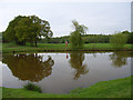
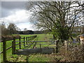
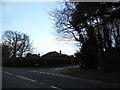
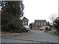
31 photos from this area
Area Information
Key information about the GU20 6PA including its size, population, and administrative classification.
- Area Type
- Postcode
- Area Size
- 19.7 hectares
- Population
- 1481
- Population Density
- 570 people/km²
House Prices in GU20 6PA
12
Properties
£818,312
Average Sold Price
£195,000
Lowest Price
£1,850,000
Highest Price
Showing 12 properties
| Address | Type | Beds | Baths | Last Sale Price | Last Sale Date | |
|---|---|---|---|---|---|---|
| Willowood, School Road, Windlesham, GU20 6PA | Detached | 4 | 2 | £1,850,000 | Mar 2021 | |
| Coopers Green, School Road, Windlesham, GU20 6PA | house | - | - | £1,300,000 | Mar 2021 | |
| Poplar Cottage, School Road, Windlesham, GU20 6PA | Detached | 3 | 2 | £549,999 | Feb 2021 | |
| Thatched Cottage, School Road, Windlesham, GU20 6PA | house | - | - | £730,000 | May 2019 | |
| 1, Wellesley Cottages, School Road, Windlesham, GU20 6PA | house | 3 | - | £785,000 | Aug 2015 | |
| Forge Cottage, School Road, Windlesham, GU20 6PA | Bungalow | 3 | 2 | £525,000 | Feb 2013 | |
| Windle Cottage, School Road, Windlesham, GU20 6PA | Detached | 5 | 4 | £611,500 | Jun 1999 | |
| 2, Wellesley Cottages, School Road, Windlesham, GU20 6PA | Semi-detached | - | - | £195,000 | Oct 1997 | |
| Meadow Cottage, School Road, Windlesham, GU20 6PA | Detached | 3 | - | - | - | |
| The Bungalow, Meadow Cottage, School Road, Windlesham, GU20 6PA | undefined | - | - | - | - |
Page 1 of 2
Energy Efficiency in GU20 6PA
Amenities
Schools
| Rank | School | Type | Entry gender | Ages |
|---|
Explore more schools in this area
Go to Schools tabDemographics
Household Size
Two person
most common
Accommodation Type
Houses
most common
Tenure
73
majority
Ethnic Group
White
most common
Religion
N/A
most common
Household Composition
N/A
most common
Age
47
median
Adults (30-64 years)
most common
Household Deprivation
N/A
with no deprivation
NS-SEC
45
in Lower managerial occupations
Explore more demographic insights in this area
Go to Demographics tabPlanning
Planning Constraints
- Flood RiskPremium
- Ramsar Wetland SitesPremium
- Area of Outstanding Natural BeautyPremium
- Protected Nature ReservePremium
- Protected WoodlandPremium