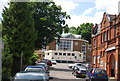
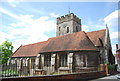
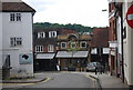
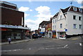
Area Overview for GU2 4YL
Photos of GU2 4YL


Area Information
Living in GU2 4YL means inhabiting a tightly packed residential cluster in England’s south-east, where 1,353 people reside across just 506 square metres. This high population density shapes a compact, community-focused environment, with homes closely spaced and daily life revolving around shared spaces. The area’s proximity to Guildford offers easy access to retail, transport, and services, while its small size ensures a sense of intimacy. Residents benefit from nearby rail links, including Guildford and Shalford stations, which connect to major routes. The area’s character is defined by its blend of practical living and urban convenience, with flats dominating the housing stock. While the population is small, the density fosters a close-knit atmosphere, though it may feel cramped for those seeking more open spaces. The absence of natural constraints like protected woodlands or wetlands means development is unimpeded, though the medium crime risk score of 44 suggests standard security measures are advisable. For buyers, GU2 4YL offers a mix of affordability and accessibility, though its limited size means the area itself is best viewed as part of a broader regional context.
- Area Type
- Postcode
- Area Size
- 506 m²
- Population
- 1353
- Population Density
- 4074 people/km²
The property market in GU2 4YL is defined by its high density and reliance on flats, which make up the majority of housing stock. With 50% of residents owning their homes, the area is neither entirely a rental market nor purely owner-occupied, but the dominance of flats suggests a mix of long-term residents and tenants. The small size of the postcode—just 506 square metres—means the housing stock is limited, and buyers must consider the broader Guildford region for more options. Flats in this area are likely to be in multi-unit buildings, offering affordability but limited private outdoor space. The compact nature of GU2 4YL may appeal to those prioritising convenience over space, though the high population density could deter buyers seeking larger homes. For investors, the 50% home ownership rate indicates a balanced market, but the lack of data on property prices or rental yields means potential buyers should explore surrounding areas for a fuller picture.
House Prices in GU2 4YL
Showing 3 properties
| Address | Type | Beds | Baths | Last Sale Price | Last Sale Date | |
|---|---|---|---|---|---|---|
| Insurance Services, 4 The Mount, Guildford, GU2 4YL | Office | - | - | - | - | |
| Kulika Charitable Trust, Ground Floor, 4 The Mount, Guildford, GU2 4YL | Office | - | - | - | - | |
| Insurance Services, First Floor, 4 The Mount, Guildford, GU2 4YL | Office | - | - | - | - |
Energy Efficiency in GU2 4YL
Life in GU2 4YL is shaped by its proximity to retail and transport hubs. The area’s five retail outlets include major names like Tesco Guildford and M&S Guildford, offering everyday shopping and dining options. These amenities are complemented by rail links to Guildford and Shalford stations, which connect to broader networks and enable easy access to cultural, professional, and recreational opportunities in nearby towns. While the area itself lacks parks or leisure facilities, its location near Guildford means residents can access larger green spaces, restaurants, and entertainment venues. The compact nature of GU2 4YL fosters a convenient lifestyle, with essential services within walking distance. However, the lack of local parks or recreational areas may require residents to travel slightly further for outdoor activities. The mix of retail and transport options ensures daily life is practical, though the area’s small size means its character is best experienced in the context of surrounding regions.
Amenities
Schools
| Rank | School | Type | Entry gender | Ages |
|---|
Explore more schools in this area
Go to Schools tabDemographics
The community in GU2 4YL is predominantly middle-aged, with a median age of 47 and the majority of residents falling within the 30-64 age range. This suggests a stable population of working-age adults, many of whom may be established professionals or families. Home ownership is split evenly, with 50% of residents owning their homes and the other half likely renting. The accommodation type is almost exclusively flats, reflecting a high-rise or terraced housing model typical of densely populated areas. The predominant ethnic group is White, though no specific data on diversity beyond this is provided. The area’s demographic profile indicates a mature, settled population, which may influence local services and amenities. However, the high population density—2.67 million people per square kilometre—raises questions about living space quality, though this is offset by proximity to urban centres. The absence of detailed deprivation data means it is unclear how economic factors shape daily life, but the age range suggests a community focused on stability rather than rapid change.
Household Size
Accommodation Type
Tenure
Ethnic Group
Religion
Household Composition
Age
Household Deprivation
NS-SEC
Explore more demographic insights in this area
Go to Demographics tabPlanning
Planning Constraints
- Flood RiskPremium
- Ramsar Wetland SitesPremium
- Area of Outstanding Natural BeautyPremium
- Protected Nature ReservePremium
- Protected WoodlandPremium