Area Overview for GU19 5DT
Photos of GU19 5DT

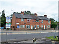
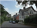


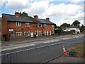
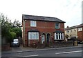
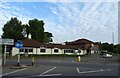
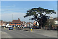

38 photos from this area
Area Information
Key information about the GU19 5DT including its size, population, and administrative classification.
- Area Type
- Postcode
- Area Size
- 3818 m²
- Population
- 1641
- Population Density
- 460 people/km²
House Prices in GU19 5DT
11
Properties
£267,160
Average Sold Price
£171,950
Lowest Price
£347,500
Highest Price
Showing 11 properties
| Address | Type | Beds | Baths | Last Sale Price | Last Sale Date | |
|---|---|---|---|---|---|---|
| 49 London Road, Bagshot, GU19 5DT | Terraced | 2 | 2 | £347,500 | Jun 2025 | |
| 53 London Road, Bagshot, GU19 5DT | Terraced | 2 | 1 | £315,000 | Nov 2023 | |
| 57 London Road, Bagshot, GU19 5DT | Terraced | 2 | 1 | £310,000 | Oct 2023 | |
| 41 London Road, Bagshot, GU19 5DT | Cottage | 2 | 1 | £260,000 | Dec 2015 | |
| 43 London Road, Bagshot, GU19 5DT | house | 2 | - | £198,508 | May 2010 | |
| 55 London Road, Bagshot, GU19 5DT | house | - | - | £171,950 | Mar 2010 | |
| House Music Ltd, One Mulberry Court, 59A London Road, Bagshot, GU19 5DT | office_workshop | - | - | - | - | |
| Eurodata Building Services Ltd, 59 London Road, Bagshot, GU19 5DT | office_workshop | - | - | - | - | |
| Babolat Vs Uk Ltd, Two Mulberry Court, 59B London Road, Bagshot, GU19 5DT | office_workshop | - | - | - | - | |
| 49A London Road, Bagshot, GU19 5DT | Detached | - | - | - | - |
Page 1 of 2
Energy Efficiency in GU19 5DT
Amenities
Schools
| Rank | School | Type | Entry gender | Ages |
|---|
Explore more schools in this area
Go to Schools tabDemographics
Household Size
Two person
most common
Accommodation Type
Houses
most common
Tenure
81
majority
Ethnic Group
White
most common
Religion
N/A
most common
Household Composition
N/A
most common
Age
47
median
Adults (30-64 years)
most common
Household Deprivation
N/A
with no deprivation
NS-SEC
47
in Lower managerial occupations
Explore more demographic insights in this area
Go to Demographics tabPlanning
Planning Constraints
- Flood RiskPremium
- Ramsar Wetland SitesPremium
- Area of Outstanding Natural BeautyPremium
- Protected Nature ReservePremium
- Protected WoodlandPremium