Area Overview for GU18 5YR
Photos of GU18 5YR
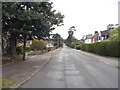
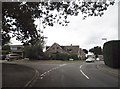
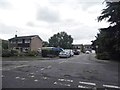
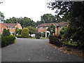


32 photos from this area
Area Information
Key information about the GU18 5YR including its size, population, and administrative classification.
- Area Type
- Postcode
- Area Size
- 2.0 hectares
- Population
- 1681
- Population Density
- 3705 people/km²
House Prices in GU18 5YR
35
Properties
£412,698
Average Sold Price
£141,000
Lowest Price
£770,000
Highest Price
Showing 35 properties
| Address | Type | Beds | Baths | Last Sale Price | Last Sale Date | |
|---|---|---|---|---|---|---|
| 28 Northfield, Lightwater, GU18 5YR | house | 4 | 2 | £770,000 | Oct 2022 | |
| 33 Northfield, Lightwater, GU18 5YR | Detached | 4 | 2 | £675,000 | Apr 2022 | |
| 23 Northfield, Lightwater, GU18 5YR | Detached | 4 | 2 | £570,000 | Nov 2021 | |
| 2 Northfield, Lightwater, GU18 5YR | Detached | 5 | 2 | £600,000 | Feb 2021 | |
| 18 Northfield, Lightwater, GU18 5YR | Detached | 4 | - | £572,000 | Feb 2021 | |
| 9 Northfield, Lightwater, GU18 5YR | Detached | 4 | - | £560,000 | Dec 2020 | |
| 20 Northfield, Lightwater, GU18 5YR | Detached | 4 | - | £537,500 | Apr 2014 | |
| 7 Northfield, Lightwater, GU18 5YR | Detached | 4 | - | £390,000 | Oct 2011 | |
| 11 Northfield, Lightwater, GU18 5YR | house | - | - | £460,000 | Jul 2010 | |
| 6 Northfield, Lightwater, GU18 5YR | Detached | - | - | £465,000 | Aug 2008 |
Page 1 of 4
Energy Efficiency in GU18 5YR
Amenities
Schools
| Rank | School | Type | Entry gender | Ages |
|---|
Explore more schools in this area
Go to Schools tabDemographics
Household Size
Two person
most common
Accommodation Type
Houses
most common
Tenure
86
majority
Ethnic Group
White
most common
Religion
N/A
most common
Household Composition
N/A
most common
Age
47
median
Adults (30-64 years)
most common
Household Deprivation
N/A
with no deprivation
NS-SEC
51
in Lower managerial occupations
Explore more demographic insights in this area
Go to Demographics tabPlanning
Planning Constraints
- Flood RiskPremium
- Ramsar Wetland SitesPremium
- Area of Outstanding Natural BeautyPremium
- Protected Nature ReservePremium
- Protected WoodlandPremium