Area Overview for GU18 5YE
Photos of GU18 5YE
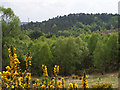
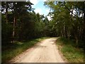
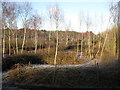
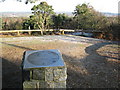
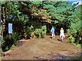
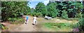
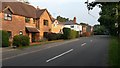
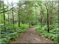
25 photos from this area
Area Information
Key information about the GU18 5YE including its size, population, and administrative classification.
- Area Type
- Postcode
- Area Size
- 8.0 hectares
- Population
- 1564
- Population Density
- 817 people/km²
House Prices in GU18 5YE
20
Properties
£504,357
Average Sold Price
£100,000
Lowest Price
£860,000
Highest Price
Showing 20 properties
| Address | Type | Beds | Baths | Last Sale Price | Last Sale Date | |
|---|---|---|---|---|---|---|
| 13 High View Road, Lightwater, GU18 5YE | Bungalow | 3 | 1 | £625,000 | Dec 2018 | |
| 6 High View Road, Lightwater, GU18 5YE | house | - | - | £620,000 | Sep 2017 | |
| 3 High View Road, Lightwater, GU18 5YE | Detached | 5 | - | £750,000 | Apr 2012 | |
| 17 High View Road, Lightwater, GU18 5YE | house | 3 | - | £480,000 | Dec 2011 | |
| 4 High View Road, Lightwater, GU18 5YE | Bungalow | 5 | - | £487,500 | Feb 2011 | |
| 12 High View Road, Lightwater, GU18 5YE | house | 4 | - | £860,000 | Feb 2011 | |
| Summerwood, 19 High View Road, Lightwater, GU18 5YE | Detached | 4 | 4 | £560,000 | Dec 2009 | |
| 14 High View Road, Lightwater, GU18 5YE | Detached | 5 | - | £650,000 | Nov 2009 | |
| 15 High View Road, Lightwater, GU18 5YE | Detached | 4 | 3 | £510,000 | Aug 2006 | |
| 9 High View Road, Lightwater, GU18 5YE | Detached | - | - | £557,000 | Jul 2002 |
Page 1 of 2
Energy Efficiency in GU18 5YE
Amenities
Schools
| Rank | School | Type | Entry gender | Ages |
|---|
Explore more schools in this area
Go to Schools tabDemographics
Household Size
Two person
most common
Accommodation Type
Houses
most common
Tenure
87
majority
Ethnic Group
White
most common
Religion
N/A
most common
Household Composition
N/A
most common
Age
47
median
Adults (30-64 years)
most common
Household Deprivation
N/A
with no deprivation
NS-SEC
54
in Lower managerial occupations
Explore more demographic insights in this area
Go to Demographics tabPlanning
Planning Constraints
- Flood RiskPremium
- Ramsar Wetland SitesPremium
- Area of Outstanding Natural BeautyPremium
- Protected Nature ReservePremium
- Protected WoodlandPremium