Area Overview for GU18 5XR
Photos of GU18 5XR
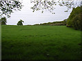
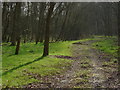
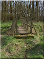
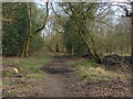
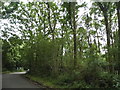
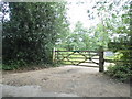
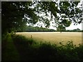
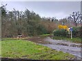
34 photos from this area
Area Information
Key information about the GU18 5XR including its size, population, and administrative classification.
- Area Type
- Postcode
- Area Size
- 21.7 hectares
- Population
- 1578
- Population Density
- 1203 people/km²
House Prices in GU18 5XR
10
Properties
£981,650
Average Sold Price
£99,950
Lowest Price
£1,770,000
Highest Price
Showing 10 properties
| Address | Type | Beds | Baths | Last Sale Price | Last Sale Date | |
|---|---|---|---|---|---|---|
| Brooklands Farm, Blackstroud Lane East, West End, Woking, GU18 5XR | Detached | 5 | 2 | £1,770,000 | Mar 2023 | |
| The Barn, Blackstroud Lane East, West End, Woking, GU18 5XR | Detached | - | - | £1,075,000 | Jun 2008 | |
| 3, Outfall Cottages, Blackstroud Lane East, Lightwater, GU18 5XR | house | 3 | - | £99,950 | Nov 1996 | |
| 2, Outfall Cottages, Blackstroud Lane East, Lightwater, GU18 5XR | Semi-detached | 3 | 2 | - | - | |
| Four Walls, Blackstroud Lane East, Lightwater, GU18 5XR | Land | 7 | - | - | - | |
| Caravan, By Pass Nursery, Blackstroud Lane East, Lightwater, GU18 5XR | Mobile Home | - | - | - | - | |
| ANNEXE, FOUR WALLS, BLACKSTROUD LANE EAST, Lightwater, GU18 5XR | Flat | - | - | - | - | |
| Annexe, Four Walls, Blackstroud Lane East, Lightwater, GU18 5XR | Flat | - | - | - | - | |
| Perfect Poultry, By Pass Nursery, Blackstroud Lane East, Lightwater, GU18 5XR | Farm | - | - | - | - | |
| 1, Outfall Cottages, Blackstroud Lane East, Lightwater, GU18 5XR | house | - | - | - | - |
Energy Efficiency in GU18 5XR
Amenities
Schools
| Rank | School | Type | Entry gender | Ages |
|---|
Explore more schools in this area
Go to Schools tabDemographics
Household Size
Family (3-5 people)
most common
Accommodation Type
Houses
most common
Tenure
75
majority
Ethnic Group
White
most common
Religion
N/A
most common
Household Composition
N/A
most common
Age
47
median
Adults (30-64 years)
most common
Household Deprivation
N/A
with no deprivation
NS-SEC
40
in Lower managerial occupations
Explore more demographic insights in this area
Go to Demographics tabPlanning
Planning Constraints
- Flood RiskPremium
- Ramsar Wetland SitesPremium
- Area of Outstanding Natural BeautyPremium
- Protected Nature ReservePremium
- Protected WoodlandPremium