Area Overview for GU18 5XA
Photos of GU18 5XA
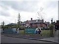
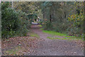
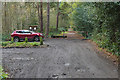
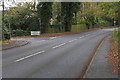
48 photos from this area
Area Information
Key information about the GU18 5XA including its size, population, and administrative classification.
- Area Type
- Postcode
- Area Size
- 3.2 hectares
- Population
- 1505
- Population Density
- 507 people/km²
House Prices in GU18 5XA
10
Properties
£613,333
Average Sold Price
£247,000
Lowest Price
£1,300,000
Highest Price
Showing 10 properties
| Address | Type | Beds | Baths | Last Sale Price | Last Sale Date | |
|---|---|---|---|---|---|---|
| Wilds, The Folly, Lightwater, GU18 5XA | house | - | - | £1,300,000 | Feb 2024 | |
| Redlands, The Folly, Lightwater, GU18 5XA | Detached | 5 | 3 | £293,000 | Apr 2006 | |
| Wheatlands, The Folly, Lightwater, GU18 5XA | Detached | - | - | £247,000 | Nov 1996 | |
| Woodlands, The Folly, Lightwater, GU18 5XA | Detached | 5 | - | - | - | |
| Brookside, Red Road, Lightwater, GU18 5XA | undefined | - | - | - | - | |
| Sandylands, Red Road, Lightwater, GU18 5XA | undefined | - | - | - | - | |
| Brookside, The Folly, Lightwater, GU18 5XA | Detached | - | - | - | - | |
| Chalet A, Redlands, The Folly, Lightwater, GU18 5XA | Farm | - | - | - | - | |
| Bungalow, Redlands, The Folly, Lightwater, GU18 5XA | Mobile Home | - | - | - | - | |
| Chalet D, Redlands, The Folly, Lightwater, GU18 5XA | Mobile Home | - | - | - | - |
Energy Efficiency in GU18 5XA
Amenities
Schools
| Rank | School | Type | Entry gender | Ages |
|---|
Explore more schools in this area
Go to Schools tabDemographics
Household Size
Family (3-5 people)
most common
Accommodation Type
Houses
most common
Tenure
92
majority
Ethnic Group
White
most common
Religion
N/A
most common
Household Composition
N/A
most common
Age
47
median
Adults (30-64 years)
most common
Household Deprivation
N/A
with no deprivation
NS-SEC
51
in Lower managerial occupations
Explore more demographic insights in this area
Go to Demographics tabPlanning
Planning Constraints
- Flood RiskPremium
- Ramsar Wetland SitesPremium
- Area of Outstanding Natural BeautyPremium
- Protected Nature ReservePremium
- Protected WoodlandPremium