Area Overview for GU18 5RW
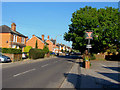
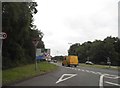
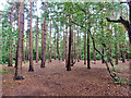
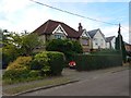
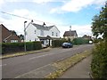
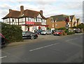
Photos of GU18 5RW


Area Information
Living in GU18 5RW means inhabiting a compact, residential cluster in England’s Surrey countryside. This postcode covers just 1.5 hectares, housing 1,578 people in a densely populated area of 1,203 people per square kilometre. The community here is largely composed of adults aged 30–64, with a median age of 47, suggesting a stable, mature population. The area’s small size means proximity to local amenities is key—residents can walk or cycle to nearby shops, schools, and transport links. With 75% of homes owned by residents, the area leans toward long-term occupancy rather than rental turnover. While the landscape lacks protected natural sites or wetlands, its safety profile is strong, with a crime risk score of 85, indicating a low likelihood of incidents. For those seeking a quiet, family-friendly environment with practical access to services, GU18 5RW offers a blend of residential comfort and connectivity.
- Area Type
- Postcode
- Area Size
- 1.5 hectares
- Population
- 1578
- Population Density
- 1203 people/km²
The property market in GU18 5RW is characterised by a high rate of home ownership—75% of properties are owner-occupied—suggesting a community of long-term residents rather than transient renters. The accommodation type is predominantly houses, which aligns with the area’s small, residential nature. This configuration implies limited scope for new developments or rental properties, making the market relatively static. For buyers, this means competition for existing homes may be fierce, particularly as the area’s compact size limits expansion. The focus on owner-occupied housing also suggests a preference for stable, family-friendly living, with homes likely prioritising space and privacy over urban convenience. Prospective buyers should consider the limited availability of new listings in this small postcode.
House Prices in GU18 5RW
Showing 22 properties
| Address | Type | Beds | Baths | Last Sale Price | Last Sale Date | |
|---|---|---|---|---|---|---|
| 130A Guildford Road, Lightwater, GU18 5RW | Detached | 5 | 2 | £660,000 | Sep 2025 | |
| 146 Guildford Road, Lightwater, GU18 5RW | Terraced | 3 | 1 | £350,000 | Feb 2025 | |
| 134 Guildford Road, Lightwater, GU18 5RW | Detached | 4 | 1 | £635,000 | Feb 2022 | |
| 150 Guildford Road, Lightwater, GU18 5RW | house | - | - | £355,000 | Jan 2022 | |
| 140 Guildford Road, Lightwater, GU18 5RW | house | - | - | £525,000 | Apr 2021 | |
| 144 Guildford Road, Lightwater, GU18 5RW | Terraced | 3 | 1 | £367,500 | Sep 2019 | |
| Greenacres, 130 Guildford Road, Lightwater, GU18 5RW | Detached | - | - | £250,000 | Jun 2002 | |
| Oakshades, 122 Guildford Road, Lightwater, GU18 5RW | undefined | - | - | £310,000 | Nov 2000 | |
| 124 Guildford Road, Lightwater, GU18 5RW | Terraced | 3 | - | £150,000 | Dec 1997 | |
| 138 Guildford Road, Lightwater, GU18 5RW | Detached | - | - | £125,000 | May 1996 |
Energy Efficiency in GU18 5RW
Daily life in GU18 5RW is shaped by its proximity to retail, dining, and transport hubs. The area’s retail landscape includes Co-op Guildford, M&S Lightwater BP, and Cook Lightwater, offering a mix of grocery and convenience shopping. Rail stations at Bagshot, Sunningdale, and Camberley provide easy access to nearby towns and cities, while Fairoaks Airport serves those requiring regional travel. Though the data does not specify parks or leisure facilities, the compact size of the postcode suggests residents rely on nearby towns for broader amenities. The combination of local shops and transport links creates a convenient, self-contained lifestyle, ideal for those seeking a balance between suburban tranquillity and urban accessibility.
Amenities
Schools
Residents of GU18 5RW have access to Lightwater Village School, which operates both as a primary school and an academy with a ‘good’ Ofsted rating. This dual designation offers families a single institution that covers early education through to secondary-level learning, reducing the need for multiple school transitions. The academy’s ‘good’ rating indicates a standard of education that meets national benchmarks, though it does not exceed them. For parents prioritising proximity and continuity in their children’s schooling, this school is a key asset. The absence of other listed schools in the data suggests this is the primary educational hub for the area, making it a critical factor in decisions about relocation or home purchase.
| Rank | School | Type | Entry gender | Ages |
|---|
Explore more schools in this area
Go to Schools tabDemographics
GU18 5RW’s population of 1,578 is concentrated in a 1.5-hectare area, resulting in a high density of 1,203 people per square kilometre. The median age of 47 reflects a community dominated by adults in their 30s to 60s, with 75% of homes owned outright by residents. This suggests a stable, long-term population with limited rental turnover. The predominant ethnic group is White, and the area’s housing stock consists primarily of houses rather than flats or apartments. The absence of specific data on deprivation means quality of life is inferred from low crime risk and proximity to amenities. The age profile indicates a mature demographic, likely with established careers and families, contributing to a steady, low-risk environment for residents.
Household Size
Accommodation Type
Tenure
Ethnic Group
Religion
Household Composition
Age
Household Deprivation
NS-SEC
Explore more demographic insights in this area
Go to Demographics tabPlanning
Planning Constraints
- Flood RiskPremium
- Ramsar Wetland SitesPremium
- Area of Outstanding Natural BeautyPremium
- Protected Nature ReservePremium
- Protected WoodlandPremium