Area Overview for GU18 5RQ
Photos of GU18 5RQ
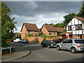
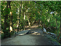
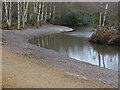
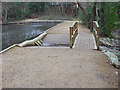
49 photos from this area
Area Information
Key information about the GU18 5RQ including its size, population, and administrative classification.
- Area Type
- Postcode
- Area Size
- 12.1 hectares
- Population
- 1564
- Population Density
- 817 people/km²
House Prices in GU18 5RQ
28
Properties
£291,895
Average Sold Price
£37,500
Lowest Price
£465,000
Highest Price
Showing 28 properties
| Address | Type | Beds | Baths | Last Sale Price | Last Sale Date | |
|---|---|---|---|---|---|---|
| 18 Stonehill Road, Lightwater, GU18 5RQ | Detached | 3 | 1 | £375,000 | Aug 2025 | |
| 6 Stonehill Road, Lightwater, GU18 5RQ | Semi-detached | 3 | 1 | £465,000 | Sep 2024 | |
| 26 Stonehill Road, Lightwater, GU18 5RQ | Semi-detached | 3 | 1 | £440,000 | May 2023 | |
| 2 Stonehill Road, Lightwater, GU18 5RQ | house | - | - | £385,000 | Feb 2021 | |
| Meikton, 27 Stonehill Road, Lightwater, GU18 5RQ | Flat | 2 | - | £285,000 | Nov 2016 | |
| 4 Stonehill Road, Lightwater, GU18 5RQ | Semi-detached | 2 | 1 | £330,000 | Dec 2015 | |
| 9 Stonehill Road, Lightwater, GU18 5RQ | Semi-detached | 2 | - | £265,000 | Oct 2015 | |
| 8 Stonehill Road, Lightwater, GU18 5RQ | Semi-detached | - | - | £197,450 | Mar 2004 | |
| 17 Stonehill Road, Lightwater, GU18 5RQ | Detached | 2 | 1 | £139,000 | Nov 2001 | |
| 3 Stonehill Road, Lightwater, GU18 5RQ | Semi-detached | - | - | £37,500 | Nov 1997 |
Page 1 of 3
Energy Efficiency in GU18 5RQ
Amenities
Schools
| Rank | School | Type | Entry gender | Ages |
|---|
Explore more schools in this area
Go to Schools tabDemographics
Household Size
Two person
most common
Accommodation Type
Houses
most common
Tenure
87
majority
Ethnic Group
White
most common
Religion
N/A
most common
Household Composition
N/A
most common
Age
47
median
Adults (30-64 years)
most common
Household Deprivation
N/A
with no deprivation
NS-SEC
54
in Lower managerial occupations
Explore more demographic insights in this area
Go to Demographics tabPlanning
Planning Constraints
- Flood RiskPremium
- Ramsar Wetland SitesPremium
- Area of Outstanding Natural BeautyPremium
- Protected Nature ReservePremium
- Protected WoodlandPremium