Area Overview for GU18 5QW
Photos of GU18 5QW
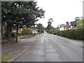
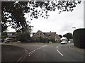
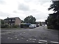
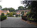
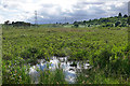
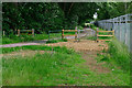
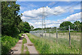
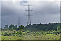
32 photos from this area
Area Information
Key information about the GU18 5QW including its size, population, and administrative classification.
- Area Type
- Postcode
- Area Size
- 1.8 hectares
- Population
- 1681
- Population Density
- 3705 people/km²
House Prices in GU18 5QW
41
Properties
£335,481
Average Sold Price
£101,000
Lowest Price
£580,000
Highest Price
Showing 41 properties
| Address | Type | Beds | Baths | Last Sale Price | Last Sale Date | |
|---|---|---|---|---|---|---|
| 60 Broom Field, Lightwater, GU18 5QW | Semi-detached | 3 | 1 | £450,000 | Dec 2024 | |
| 76 Broom Field, Lightwater, GU18 5QW | Semi-detached | 4 | 2 | £550,000 | Nov 2024 | |
| 91 Broom Field, Lightwater, GU18 5QW | Semi-detached | 2 | 1 | £410,000 | Aug 2023 | |
| 78 Broom Field, Lightwater, GU18 5QW | Detached | 4 | 2 | £580,000 | Aug 2023 | |
| 86 Broom Field, Lightwater, GU18 5QW | house | 3 | 1 | £452,000 | Sep 2022 | |
| 85 Broom Field, Lightwater, GU18 5QW | house | 2 | 1 | £360,000 | Mar 2021 | |
| 54 Broom Field, Lightwater, GU18 5QW | Semi-detached | 3 | 1 | £402,000 | Oct 2020 | |
| 66 Broom Field, Lightwater, GU18 5QW | Detached | 4 | 2 | £550,000 | Oct 2019 | |
| 84 Broom Field, Lightwater, GU18 5QW | Terraced | 2 | 1 | £320,000 | Aug 2018 | |
| 77 Broom Field, Lightwater, GU18 5QW | Detached | 4 | 3 | £555,000 | Nov 2016 |
Page 1 of 5
Energy Efficiency in GU18 5QW
Amenities
Schools
| Rank | School | Type | Entry gender | Ages |
|---|
Explore more schools in this area
Go to Schools tabDemographics
Household Size
Two person
most common
Accommodation Type
Houses
most common
Tenure
86
majority
Ethnic Group
White
most common
Religion
N/A
most common
Household Composition
N/A
most common
Age
47
median
Adults (30-64 years)
most common
Household Deprivation
N/A
with no deprivation
NS-SEC
51
in Lower managerial occupations
Explore more demographic insights in this area
Go to Demographics tabPlanning
Planning Constraints
- Flood RiskPremium
- Ramsar Wetland SitesPremium
- Area of Outstanding Natural BeautyPremium
- Protected Nature ReservePremium
- Protected WoodlandPremium