Area Overview for GU18 5HX
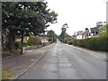
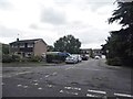
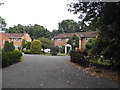
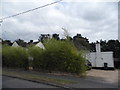
Photos of GU18 5HX


Area Information
Living in GU18 5HX means being part of a small, tightly knit residential cluster in England with a population of 1,681. This area is defined by its compact size and the presence of family-oriented housing, reflecting a community where most residents are adults aged 30–64. The area’s proximity to key amenities such as railway stations and retail hubs like Co-op Guildford and M&S Lightwater BP ensures daily convenience. With 86% of homes owned by residents, the area leans heavily towards owner-occupied properties, creating a stable, long-term community feel. The low crime risk score of 91/100 and absence of environmental constraints such as flood zones or protected natural areas make it an attractive option for those prioritising safety and practical living. For families, the mix of primary and secondary schools within reach adds to the appeal, while the digital connectivity scores of 80 (broadband) and 81 (mobile) support modern lifestyles. GU18 5HX offers a blend of residential comfort and accessible infrastructure, ideal for those seeking a balanced, low-risk living environment.
- Area Type
- Postcode
- Area Size
- Not available
- Population
- 1681
- Population Density
- 3705 people/km²
The property market in GU18 5HX is characterised by a high rate of home ownership (86%) and a focus on houses rather than flats or apartments. This indicates a community where long-term residency is common, with properties likely to be family homes rather than short-term rentals. The small area size means the housing stock is limited, which could make the market competitive for buyers. The predominance of houses suggests a preference for larger living spaces, potentially appealing to those seeking more private or spacious accommodation. However, the lack of rental properties may reduce flexibility for those needing temporary housing. Buyers should consider the proximity to amenities such as schools, rail links, and retail hubs when evaluating properties, as these factors significantly influence the area’s appeal. The stability of the market, combined with low safety risks, makes GU18 5HX a reliable choice for those prioritising security and long-term value.
House Prices in GU18 5HX
No properties found in this postcode.
Energy Efficiency in GU18 5HX
The lifestyle in GU18 5HX is shaped by its proximity to a variety of amenities. Residents can access five retail venues, including Co-op Guildford, M&S Lightwater BP, and Cook Lightwater, offering everyday shopping needs. The area’s rail links to Bagshot, Camberley, and Sunningdale provide easy access to nearby towns, while Fairoaks Airport adds convenience for travel. Though specific parks or leisure facilities are not listed, the presence of multiple retail and transport options suggests a focus on practicality over expansive green spaces. The mix of shops, dining, and transport infrastructure creates a self-contained environment where daily errands and travel are efficiently managed. This accessibility supports a lifestyle that prioritises convenience, making GU18 5HX appealing to those who value ease of movement and local services without the need for long commutes.
Amenities
Schools
Residents of GU18 5HX have access to two schools within practical reach: Hammond Community Junior School, a primary school, and Hammond School, an academy. These institutions cater to different educational stages, with the primary school likely serving younger children and the academy offering secondary education. The presence of both a primary and an academy suggests a range of educational options, though no Ofsted ratings are provided to assess quality. Families may benefit from the combination of local primary education and the structured environment of an academy. The schools’ proximity to homes reduces commuting time, which is particularly valuable for working parents. While the data does not specify academic performance or facilities, the availability of two schools within the area supports a family-friendly environment, ensuring children have access to education without long travel distances.
| Rank | School | Type | Entry gender | Ages |
|---|
Explore more schools in this area
Go to Schools tabDemographics
GU18 5HX has a median age of 47, with the majority of residents falling within the 30–64 age range. This suggests a community skewed towards established adults, likely with families or long-term careers. Home ownership is high at 86%, indicating a strong presence of long-term residents rather than transient renters. The area is predominantly composed of houses, reflecting a more traditional housing stock compared to flats or apartments. The predominant ethnic group is White, with no data provided on other demographics. The high home ownership rate and age profile suggest a mature, settled population with lower turnover. This demographic structure supports a stable local economy and community cohesion, though it may limit the diversity of age groups or household types. The absence of specific data on deprivation or income levels means the quality of life can only be inferred from the safety and infrastructure metrics provided.
Household Size
Accommodation Type
Tenure
Ethnic Group
Religion
Household Composition
Age
Household Deprivation
NS-SEC
Explore more demographic insights in this area
Go to Demographics tabPlanning
Planning Constraints
- Flood RiskPremium
- Ramsar Wetland SitesPremium
- Area of Outstanding Natural BeautyPremium
- Protected Nature ReservePremium
- Protected WoodlandPremium