Area Overview for GU17 9HZ
Photos of GU17 9HZ
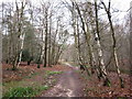
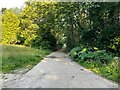
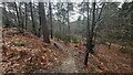
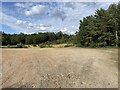
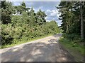
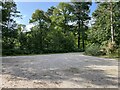
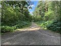
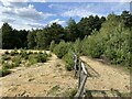
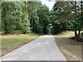
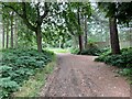
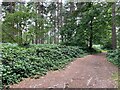

50 photos from this area
Area Information
Key information about the GU17 9HZ including its size, population, and administrative classification.
- Area Type
- Postcode
- Area Size
- 14.2 hectares
- Population
- 2555
- Population Density
- 251 people/km²
House Prices in GU17 9HZ
26
Properties
£451,821
Average Sold Price
£147,500
Lowest Price
£625,000
Highest Price
Showing 26 properties
| Address | Type | Beds | Baths | Last Sale Price | Last Sale Date | |
|---|---|---|---|---|---|---|
| 22 Woodlands Close, Blackwater, Farnborough, GU17 9HZ | house | - | - | £525,000 | Jan 2025 | |
| 10 Woodlands Close, Blackwater, Farnborough, GU17 9HZ | Detached | 4 | 2 | £610,000 | Dec 2024 | |
| 6 Woodlands Close, Blackwater, Farnborough, GU17 9HZ | Detached | 4 | 2 | £550,000 | Nov 2024 | |
| 15 Woodlands Close, Blackwater, Farnborough, GU17 9HZ | Detached | 4 | 2 | £590,000 | Feb 2023 | |
| 14 Woodlands Close, Blackwater, Farnborough, GU17 9HZ | house | - | - | £625,000 | Jun 2022 | |
| 25 Woodlands Close, Blackwater, Farnborough, GU17 9HZ | Retail | 4 | 2 | £540,000 | May 2022 | |
| 9 Woodlands Close, Blackwater, Farnborough, GU17 9HZ | house | 4 | 2 | £595,000 | Nov 2021 | |
| 27 Woodlands Close, Blackwater, Farnborough, GU17 9HZ | house | - | - | £440,000 | Dec 2017 | |
| 11 Woodlands Close, Blackwater, Farnborough, GU17 9HZ | Detached | 4 | 2 | £515,000 | Apr 2017 | |
| 17 Woodlands Close, Blackwater, Farnborough, GU17 9HZ | house | - | - | £320,000 | Aug 2011 |
Page 1 of 3
Energy Efficiency in GU17 9HZ
Amenities
Schools
| Rank | School | Type | Entry gender | Ages |
|---|
Explore more schools in this area
Go to Schools tabDemographics
Household Size
Two person
most common
Accommodation Type
Houses
most common
Tenure
77
majority
Ethnic Group
White
most common
Religion
N/A
most common
Household Composition
N/A
most common
Age
22
median
Young Adults (15-29 years)
most common
Household Deprivation
N/A
with no deprivation
NS-SEC
43
in Lower managerial occupations
Explore more demographic insights in this area
Go to Demographics tabPlanning
Planning Constraints
- Flood RiskPremium
- Ramsar Wetland SitesPremium
- Area of Outstanding Natural BeautyPremium
- Protected Nature ReservePremium
- Protected WoodlandPremium