Area Overview for GU17 7FU
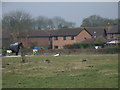
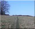
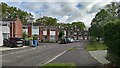
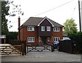
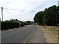
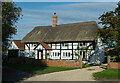
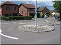
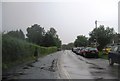
Photos of GU17 7FU


Area Information
GU17 7FU is a small residential postcode in England, home to around 1,609 people. It is a compact area, typically found in rural or semi-rural settings, where housing is predominantly family-owned. The community here is characterised by its stability, with a median age of 47 and a majority of residents aged between 30 and 64. Living in GU17 7FU means being part of a tight-knit, low-density neighbourhood where most homes are privately owned. The area’s proximity to Yateley and surrounding towns provides access to local amenities without the congestion of larger urban centres. Daily life here is shaped by the availability of nearby schools, rail links, and retail hubs, making it a practical choice for families and professionals seeking a balanced lifestyle. The low crime risk and absence of environmental constraints further enhance its appeal. For those considering homes in GU17 7FU, the combination of safety, accessibility, and community cohesion offers a clear advantage over more sprawling or isolated areas.
- Area Type
- Postcode
- Area Size
- Not available
- Population
- 1609
- Population Density
- 3327 people/km²
The property market in GU17 7FU is largely owner-occupied, with 86% of homes privately owned. This suggests a stable, low-rental market where most properties are held by residents rather than landlords. The accommodation type is predominantly houses, which is typical for smaller postcode areas with limited density. This housing stock appeals to families and professionals seeking space and privacy, as opposed to the high-rise or shared accommodation common in urban centres. The small size of the area means the housing stock is finite, which could lead to competitive demand among buyers. For those considering homes in GU17 7FU, the focus on owner-occupation and the prevalence of houses indicate a market prioritising permanence and family-friendly living. The lack of rental properties also means fewer short-term tenancies, reinforcing the area’s appeal to long-term residents.
House Prices in GU17 7FU
No properties found in this postcode.
Energy Efficiency in GU17 7FU
Living in GU17 7FU grants access to a range of amenities within practical reach. Retail options include major supermarkets such as Waitrose Yateley, Sainsburys Yateley, and Asda Yateley, ensuring convenience for daily shopping. The area’s proximity to rail stations like Sandhurst and Crowthorne adds to its connectivity, while nearby airports provide additional travel flexibility. Although the data does not mention parks or leisure facilities, the absence of environmental constraints like protected woodlands or AONB areas suggests open spaces may be available nearby. The combination of retail, transport, and regional accessibility creates a lifestyle that balances local convenience with broader opportunities. For residents, this means a mix of small-town charm and practicality, ideal for those seeking a self-contained yet connected living environment.
Amenities
Schools
GU17 7FU is served by three primary schools: Westfields Junior School, Westfields Infant School, and Yateley School. All three have been rated as “good” by Ofsted, reflecting consistent standards in education. The presence of two infant and one junior school provides a seamless transition for young children, making the area particularly attractive to families with school-age children. The mix of primary schools ensures coverage for early years education through to the final year of primary schooling. However, no secondary schools are listed in the data, which may require families to commute to nearby towns for further education. The quality of these schools, combined with their proximity to homes in GU17 7FU, enhances the area’s appeal as a family-friendly location.
| Rank | School | Type | Entry gender | Ages |
|---|
Explore more schools in this area
Go to Schools tabDemographics
The population of GU17 7FU is predominantly composed of adults aged 30 to 64, reflecting a mature, established community. The median age of 47 suggests a demographic skewed towards middle-aged individuals, likely including professionals and families. Home ownership is high, with 86% of residents owning their properties, indicating a stable housing market. The area is dominated by houses rather than flats or apartments, which aligns with the typical characteristics of smaller rural or semi-rural postcode areas. The predominant ethnic group is White, though no specific data on diversity or deprivation is provided. This demographic profile suggests a community focused on long-term residency, with limited turnover. The absence of detailed diversity metrics means the area’s cultural composition remains opaque, but the high home ownership and age distribution point to a settled, low-mobility population.
Household Size
Accommodation Type
Tenure
Ethnic Group
Religion
Household Composition
Age
Household Deprivation
NS-SEC
Explore more demographic insights in this area
Go to Demographics tabPlanning
Planning Constraints
- Flood RiskPremium
- Ramsar Wetland SitesPremium
- Area of Outstanding Natural BeautyPremium
- Protected Nature ReservePremium
- Protected WoodlandPremium