Area Overview for GU17 0EP
Photos of GU17 0EP
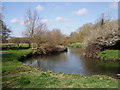

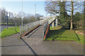
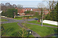
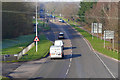
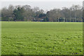
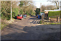
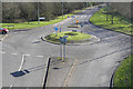
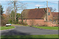
39 photos from this area
Area Information
Key information about the GU17 0EP including its size, population, and administrative classification.
- Area Type
- Postcode
- Area Size
- 1.8 hectares
- Population
- 1409
- Population Density
- 5688 people/km²
House Prices in GU17 0EP
45
Properties
£200,384
Average Sold Price
£46,000
Lowest Price
£305,000
Highest Price
Showing 45 properties
| Address | Type | Beds | Baths | Last Sale Price | Last Sale Date | |
|---|---|---|---|---|---|---|
| 2 Hearsey Gardens, Blackwater, Camberley, GU17 0EP | Terraced | 3 | 1 | £305,000 | Apr 2024 | |
| 28 Hearsey Gardens, Blackwater, Camberley, GU17 0EP | Terraced | 3 | 1 | £300,000 | Nov 2023 | |
| 24 Hearsey Gardens, Blackwater, Camberley, GU17 0EP | Terraced | 3 | 1 | £290,000 | Oct 2021 | |
| 25 Hearsey Gardens, Blackwater, Camberley, GU17 0EP | Terraced | 3 | 1 | £260,000 | May 2020 | |
| 21 Hearsey Gardens, Blackwater, Camberley, GU17 0EP | Terraced | 3 | - | £250,000 | Dec 2019 | |
| 30 Hearsey Gardens, Blackwater, Camberley, GU17 0EP | Terraced | 3 | - | £265,000 | Sep 2018 | |
| 27 Hearsey Gardens, Blackwater, Camberley, GU17 0EP | house | 3 | - | £248,000 | Jul 2015 | |
| 11 Hearsey Gardens, Blackwater, Camberley, GU17 0EP | house | - | - | £250,000 | Jun 2015 | |
| 17 Hearsey Gardens, Blackwater, Camberley, GU17 0EP | Terraced | - | - | £166,000 | May 2013 | |
| 1 Hearsey Gardens, Blackwater, Camberley, GU17 0EP | Terraced | 3 | - | £83,000 | Mar 1999 |
Page 1 of 5
Energy Efficiency in GU17 0EP
Amenities
Schools
| Rank | School | Type | Entry gender | Ages |
|---|
Explore more schools in this area
Go to Schools tabDemographics
Household Size
Family (3-5 people)
most common
Accommodation Type
Houses
most common
Tenure
67
majority
Ethnic Group
White
most common
Religion
N/A
most common
Household Composition
N/A
most common
Age
47
median
Adults (30-64 years)
most common
Household Deprivation
N/A
with no deprivation
NS-SEC
25
in Lower managerial occupations
Explore more demographic insights in this area
Go to Demographics tabPlanning
Planning Constraints
- Flood RiskPremium
- Ramsar Wetland SitesPremium
- Area of Outstanding Natural BeautyPremium
- Protected Nature ReservePremium
- Protected WoodlandPremium