Area Overview for GU16 8PF
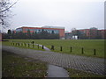
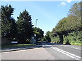
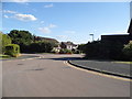
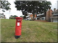
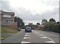
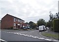
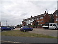
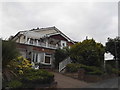
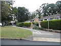
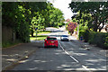
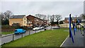
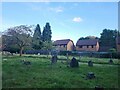
Photos of GU16 8PF
Area Information
GU16 8PF is a compact, densely populated residential area in England, covering just 2.1 hectares and home to 1504 residents. Its high population density of 71,486 people per square kilometre reflects a tightly knit community, likely characterised by close proximity to shared amenities and services. The area’s small size suggests a focused, localised environment, possibly centred around a core of homes with limited expansion. With a median age of 47 and a majority of residents aged 30–64, it is a mature community, likely dominated by long-term residents and families. The high home ownership rate of 91% indicates a stable, settled population, with most properties being owner-occupied rather than rented. This suggests a conservative, perhaps traditional neighbourhood where property values may be relatively stable. The area’s proximity to retail, transport, and educational facilities makes it appealing for those seeking convenience without sacrificing a sense of community.
- Area Type
- Postcode
- Area Size
- 2.1 hectares
- Population
- 1504
- Population Density
- 3100 people/km²
GU16 8PF is predominantly an owner-occupied area, with 91% of properties owned by their residents. The accommodation type is exclusively houses, indicating a lack of flats or apartments. This suggests a market focused on family homes, likely with larger gardens or outdoor spaces. The small area size and high population density imply limited new development, making the housing stock relatively fixed. For buyers, this means a limited selection of properties, but potentially stable values due to the area’s established character. The high home ownership rate also suggests a community with long-term residents, which may influence property prices and desirability. Proximity to schools, retail, and transport links could further enhance the appeal of owner-occupied homes here, though the compact nature of the area may restrict expansion or new builds.
House Prices in GU16 8PF
Showing 29 properties
| Address | Type | Beds | Baths | Last Sale Price | Last Sale Date | |
|---|---|---|---|---|---|---|
| 22 Chobham Road, Frimley, Camberley, GU16 8PF | Detached | 3 | 1 | £565,000 | Mar 2023 | |
| 50 Chobham Road, Frimley, Camberley, GU16 8PF | Bungalow | 2 | 1 | £530,000 | Jan 2022 | |
| 24 Chobham Road, Frimley, Camberley, GU16 8PF | Semi-detached | 4 | 2 | £500,000 | Aug 2016 | |
| 30 Chobham Road, Frimley, Camberley, GU16 8PF | house | 4 | 2 | £350,000 | Nov 2013 | |
| 48 Chobham Road, Frimley, Camberley, GU16 8PF | house | - | - | £460,000 | Sep 2010 | |
| 20 Chobham Road, Frimley, Camberley, GU16 8PF | Semi-detached | - | - | £400,000 | Jan 2010 | |
| 58 Chobham Road, Frimley, Camberley, GU16 8PF | Detached | - | - | £499,000 | Oct 2007 | |
| 60 Chobham Road, Frimley, Camberley, GU16 8PF | Detached | - | - | £589,950 | Sep 2007 | |
| The Old Stables, 32 Chobham Road, Frimley, Camberley, GU16 8PF | Detached | 4 | 2 | £680,000 | Jul 2007 | |
| 64 Chobham Road, Frimley, Camberley, GU16 8PF | house | - | - | £275,000 | Nov 1999 |
Energy Efficiency in GU16 8PF
Residents of GU16 8PF have access to a range of nearby amenities, including five retail outlets such as Waitrose Frimley, Tesco Frimley, and Asda Frimley, ensuring everyday shopping needs are met. The proximity to rail stations and airports enhances mobility, allowing easy access to broader regional networks. While the area itself is small, its connections to surrounding towns and cities provide opportunities for dining, leisure, and cultural activities beyond its immediate boundaries. The presence of multiple schools and the compact nature of the area suggest a community-oriented lifestyle, with shared spaces and services prioritised over large-scale developments. This balance of convenience and local focus may appeal to those seeking a self-contained yet connected living environment.
Amenities
Schools
The area is served by a range of schools, including Burrow Hill School, a special school catering to students with specific educational needs, and several primary schools such as Lakeside Primary School, Tomlinscote School and Sixth Form College, and Lakeside First School. Clewborough House Preparatory School offers independent education for younger children. This mix of school types provides options for families with varying requirements, from state-funded primary education to specialist support and private schooling. The presence of multiple primary schools suggests a focus on early education, while the inclusion of a special school highlights accessibility for students with additional needs. Families seeking a range of educational pathways may find this diversity advantageous, though the absence of secondary schools within the area may require commuting for older children.
| Rank | School | Type | Entry gender | Ages |
|---|
Explore more schools in this area
Go to Schools tabDemographics
The population of GU16 8PF is predominantly adults aged 30–64, with a median age of 47. This suggests a community of established professionals, families, and retirees, with fewer young children or elderly residents compared to other areas. The high home ownership rate of 91% indicates a strong preference for long-term residency, with few rental properties. The accommodation type is primarily houses, which aligns with the area’s low population density relative to its size. The predominant ethnic group is White, with no data provided on other demographics. The high proportion of adults in the 30–64 age range may reflect a lack of recent migration or a focus on family-oriented living. This profile suggests a community with stable employment patterns and a focus on domestic life, though it may lack the diversity of younger or older age groups.
Household Size
Accommodation Type
Tenure
Ethnic Group
Religion
Household Composition
Age
Household Deprivation
NS-SEC
Explore more demographic insights in this area
Go to Demographics tabPlanning
Planning Constraints
- Flood RiskPremium
- Ramsar Wetland SitesPremium
- Area of Outstanding Natural BeautyPremium
- Protected Nature ReservePremium
- Protected WoodlandPremium