Area Overview for GU16 7JE
Photos of GU16 7JE
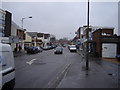
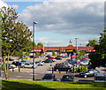

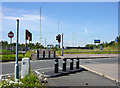
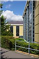
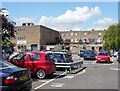
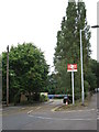
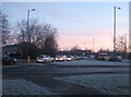
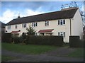
100 photos from this area
Area Information
Key information about the GU16 7JE including its size, population, and administrative classification.
- Area Type
- Postcode
- Area Size
- 3618 m²
- Population
- 1815
- Population Density
- 2345 people/km²
House Prices in GU16 7JE
23
Properties
£100,700
Average Sold Price
£91,400
Lowest Price
£110,000
Highest Price
Showing 23 properties
| Address | Type | Beds | Baths | Last Sale Price | Last Sale Date | |
|---|---|---|---|---|---|---|
| 72A Frimley High Street, Frimley, Camberley, GU16 7JE | Terraced | - | - | £91,400 | Jul 2002 | |
| 68A Frimley High Street, Frimley, Camberley, GU16 7JE | Terraced | - | - | £110,000 | Dec 1996 | |
| 64A Frimley High Street, Frimley, Camberley, GU16 7JE | Flat | 4 | 1 | - | - | |
| Flat, 94 Frimley High Street, Frimley, Camberley, GU16 7JE | Retail | - | 1 | - | - | |
| 64C Frimley High Street, Frimley, Camberley, GU16 7JE | Flat | 1 | 1 | - | - | |
| Main Allen Property Consultancy Ltd, 72 Frimley High Street, Frimley, Camberley, GU16 7JE | shop | - | - | - | - | |
| 74 Frimley High Street, Frimley, Camberley, GU16 7JE | office_workshop | - | - | - | - | |
| Redacted, 68 Frimley High Street, Frimley, Camberley, GU16 7JE | Retail | - | - | - | - | |
| 66A Frimley High Street, Frimley, Camberley, GU16 7JE | Terraced | - | - | - | - | |
| Enterprise Consulting, 96A Frimley High Street, Frimley, Camberley, GU16 7JE | retail_financial | - | - | - | - |
Page 1 of 3
Energy Efficiency in GU16 7JE
Amenities
Schools
| Rank | School | Type | Entry gender | Ages |
|---|
Explore more schools in this area
Go to Schools tabDemographics
Household Size
Family (3-5 people)
most common
Accommodation Type
Houses
most common
Tenure
61
majority
Ethnic Group
White
most common
Religion
N/A
most common
Household Composition
N/A
most common
Age
47
median
Adults (30-64 years)
most common
Household Deprivation
N/A
with no deprivation
NS-SEC
39
in Lower managerial occupations
Explore more demographic insights in this area
Go to Demographics tabPlanning
Planning Constraints
- Flood RiskPremium
- Ramsar Wetland SitesPremium
- Area of Outstanding Natural BeautyPremium
- Protected Nature ReservePremium
- Protected WoodlandPremium