Area Overview for GU16 6TS
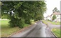
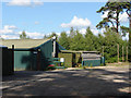
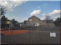
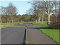
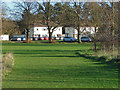
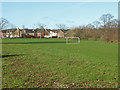
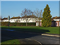
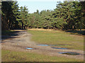
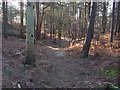
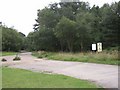
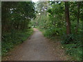
Photos of GU16 6TS

Area Information
GU16 6TS is a compact residential postcode in England, covering 5.5 hectares and home to 2,494 residents. The area’s small size means it is likely a tight-knit community, with a population density of 424 people per square kilometre. This postcode is characterised by a mix of housing stock, though the data suggests a predominance of houses rather than flats or apartments. The median age of 47 indicates a mature demographic, with the majority of residents falling within the 30-64 age range. This suggests a stable, established community with a focus on family life and long-term residency. Daily life here is likely shaped by proximity to local amenities, including retail outlets, rail links, and an airport. The area’s small footprint means it is probably surrounded by larger towns or cities, offering access to broader services while maintaining a quiet, residential atmosphere. With a home ownership rate of 60%, the area is not heavily reliant on rentals, which may influence the dynamics of the local housing market. For buyers, this postcode offers a blend of practicality and accessibility, with nearby schools and transport options adding to its appeal.
- Area Type
- Postcode
- Area Size
- 5.5 hectares
- Population
- 2494
- Population Density
- 424 people/km²
GU16 6TS is a small postcode with a home ownership rate of 60%, indicating that nearly two-thirds of properties are owner-occupied. The accommodation type is predominantly houses, which suggests a focus on single-family homes rather than apartments or terraced housing. This mix may appeal to buyers seeking traditional, spacious properties, though the limited area size means the housing stock is constrained. As a small residential cluster, the property market here is likely to be niche, with limited availability for buyers. The owner-occupied nature of the area may mean fewer rental properties, which could be a consideration for those seeking investment opportunities. The proximity to nearby towns and transport links may make this area attractive for commuters or those looking for a quieter base while still being connected to larger services.
House Prices in GU16 6TS
Showing 58 properties
| Address | Type | Beds | Baths | Last Sale Price | Last Sale Date | |
|---|---|---|---|---|---|---|
| 2 Alma Gardens, Deepcut, Camberley, GU16 6TS | Detached | - | - | - | - | |
| 3 Alma Gardens, Deepcut, Camberley, GU16 6TS | Terraced | - | - | - | - | |
| 15 Alma Gardens, Deepcut, Camberley, GU16 6TS | Detached | - | - | - | - | |
| 38 Alma Gardens, Deepcut, Camberley, GU16 6TS | Detached | - | - | - | - | |
| 6 Alma Gardens, Deepcut, Camberley, GU16 6TS | Detached | - | - | - | - | |
| 43 Alma Gardens, Deepcut, Camberley, GU16 6TS | Detached | - | - | - | - | |
| 47 Alma Gardens, Deepcut, Camberley, GU16 6TS | Terraced | - | - | - | - | |
| 20 Alma Gardens, Deepcut, Camberley, GU16 6TS | Detached | - | - | - | - | |
| 25 Alma Gardens, Deepcut, Camberley, GU16 6TS | Detached | - | - | - | - | |
| 45 Alma Gardens, Deepcut, Camberley, GU16 6TS | Detached | - | - | - | - |
Energy Efficiency in GU16 6TS
Living in GU16 6TS offers access to a range of amenities within practical reach. The retail sector includes major supermarkets such as Morrisons Daily, Sainsburys Frimley, and Tesco Frimley, providing convenience for daily shopping needs. The area is also well-connected by rail, with stations like Farnborough North, Frimley, and Brookwood offering links to broader transport networks. Farnborough Airport is a nearby facility, adding to the area’s connectivity. While the data does not specify parks or leisure facilities, the presence of multiple retail and transport options suggests a lifestyle that balances convenience with accessibility. The mix of shops and transport links likely supports a practical, community-oriented daily life.
Amenities
Schools
Residents of GU16 6TS have access to three notable schools within practical reach. Blackdown Primary School serves the local community, providing primary education. Cheswycks School is an independent institution, offering an alternative to state-funded education. Portesbery School is a special school, catering to students with specific educational needs. The presence of a primary school and an independent option provides families with choices, while the special school ensures support for those requiring tailored education. This mix suggests a well-rounded educational landscape, though the data does not include Ofsted ratings or specific academic performance metrics. The availability of these schools may be a key factor for families prioritising education in their property search.
| Rank | School | Type | Entry gender | Ages |
|---|
Explore more schools in this area
Go to Schools tabDemographics
The population of GU16 6TS is 2,494, with a median age of 47. The majority of residents fall within the 30-64 age range, reflecting a community of working-age adults and older families. Home ownership is at 60%, suggesting a balance between owner-occupied properties and rental units. The accommodation type is primarily houses, which aligns with the area’s likely suburban or semi-rural character. The predominant ethnic group is White, though no specific data on diversity or deprivation is provided. The population density of 424 people per square kilometre indicates a moderately populated area, which may contribute to a sense of community without the congestion of denser urban zones. With 60% of residents owning their homes, the area is likely to have a stable housing market, though the smaller size of the postcode means the pool of properties is limited. This demographic profile suggests a focus on long-term residency and family-oriented living.
Household Size
Accommodation Type
Tenure
Ethnic Group
Religion
Household Composition
Age
Household Deprivation
NS-SEC
Explore more demographic insights in this area
Go to Demographics tabPlanning
Planning Constraints
- Flood RiskPremium
- Ramsar Wetland SitesPremium
- Area of Outstanding Natural BeautyPremium
- Protected Nature ReservePremium
- Protected WoodlandPremium