Area Overview for GU15 4HU
Photos of GU15 4HU
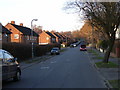
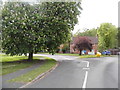
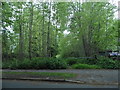
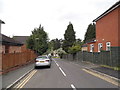
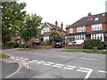
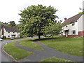
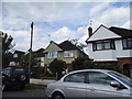
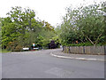
26 photos from this area
Area Information
Key information about the GU15 4HU including its size, population, and administrative classification.
- Area Type
- Postcode
- Area Size
- 3.0 hectares
- Population
- 1742
- Population Density
- 1960 people/km²
House Prices in GU15 4HU
23
Properties
£597,375
Average Sold Price
£322,500
Lowest Price
£1,125,000
Highest Price
Showing 23 properties
| Address | Type | Beds | Baths | Last Sale Price | Last Sale Date | |
|---|---|---|---|---|---|---|
| Whitecote, 19 Kings Ride, Camberley, GU15 4HU | Detached | 4 | 2 | £1,125,000 | Oct 2022 | |
| 13 Kings Ride, Camberley, GU15 4HU | Detached | 5 | 2 | £530,000 | Jan 2011 | |
| Kings Ride Lodge, Kings Ride, Camberley, GU15 4HU | Flat | 2 | 1 | £412,000 | Nov 2010 | |
| 11A Kings Ride, Camberley, GU15 4HU | Detached | - | - | £322,500 | Jul 1999 | |
| Inglenook, 11B Kings Ride, Camberley, GU15 4HU | Detached | 5 | 3 | - | - | |
| Kings Ride House, 11 Kings Ride, Camberley, GU15 4HU | Retail | 4 | 3 | - | - | |
| 10, Wychwood, 15 Kings Ride, Camberley, GU15 4HU | Flat | 2 | 1 | - | - | |
| 7 Kings Ride, Camberley, GU15 4HU | Detached | 4 | 2 | - | - | |
| 6, Wychwood, 15 Kings Ride, Camberley, GU15 4HU | Flat | 6 | - | - | - | |
| 15 Kings Ride, Camberley, GU15 4HU | Flat | 2 | 2 | - | - |
Page 1 of 3
Energy Efficiency in GU15 4HU
Amenities
Schools
| Rank | School | Type | Entry gender | Ages |
|---|
Explore more schools in this area
Go to Schools tabDemographics
Household Size
Family (3-5 people)
most common
Accommodation Type
Houses
most common
Tenure
44
majority
Ethnic Group
White
most common
Religion
N/A
most common
Household Composition
N/A
most common
Age
47
median
Adults (30-64 years)
most common
Household Deprivation
N/A
with no deprivation
NS-SEC
45
in Lower managerial occupations
Explore more demographic insights in this area
Go to Demographics tabPlanning
Planning Constraints
- Flood RiskPremium
- Ramsar Wetland SitesPremium
- Area of Outstanding Natural BeautyPremium
- Protected Nature ReservePremium
- Protected WoodlandPremium