Area Overview for GU15 3TP
Photos of GU15 3TP

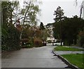
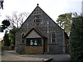
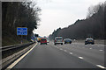
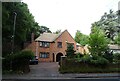
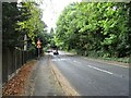
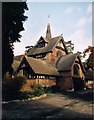
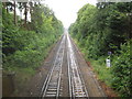
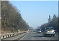
22 photos from this area
Area Information
Key information about the GU15 3TP including its size, population, and administrative classification.
- Area Type
- Postcode
- Area Size
- 1.9 hectares
- Population
- 1847
- Population Density
- 3112 people/km²
House Prices in GU15 3TP
24
Properties
£737,000
Average Sold Price
£525,000
Lowest Price
£905,000
Highest Price
Showing 24 properties
| Address | Type | Beds | Baths | Last Sale Price | Last Sale Date | |
|---|---|---|---|---|---|---|
| Grantchester, Portesbery Hill Drive, Camberley, GU15 3TP | house | - | - | £905,000 | Sep 2014 | |
| Foxhaven, Portesbery Hill Drive, Camberley, GU15 3TP | house | - | - | £750,000 | Dec 2011 | |
| Hunters Lodge, Portesbery Hill Drive, Camberley, GU15 3TP | Detached | - | - | £895,000 | Jun 2007 | |
| Poolside, Portesbery Hill Drive, Camberley, GU15 3TP | house | - | - | £610,000 | Feb 2007 | |
| Avoca, Portesbery Hill Drive, Camberley, GU15 3TP | Detached | - | - | £525,000 | Nov 2003 | |
| Flat 1, The Manor House, Portesbery Hill Drive, Camberley, GU15 3TP | Flat | 2 | 1 | - | - | |
| Flat 7, The Manor House, Portesbery Hill Drive, Camberley, GU15 3TP | Flat | 2 | 1 | - | - | |
| Flat 6, The Manor House, Portesbery Hill Drive, Camberley, GU15 3TP | Flat | 2 | 1 | - | - | |
| Portesbery Close, Portesbery Hill Drive, Camberley, GU15 3TP | Retail | 2 | 1 | - | - | |
| Flat 10, The Manor House, Portesbery Hill Drive, Camberley, GU15 3TP | Flat | 2 | 2 | - | - |
Page 1 of 3
Energy Efficiency in GU15 3TP
Amenities
Schools
| Rank | School | Type | Entry gender | Ages |
|---|
Explore more schools in this area
Go to Schools tabDemographics
Household Size
Two person
most common
Accommodation Type
Houses
most common
Tenure
79
majority
Ethnic Group
White
most common
Religion
N/A
most common
Household Composition
N/A
most common
Age
47
median
Adults (30-64 years)
most common
Household Deprivation
N/A
with no deprivation
NS-SEC
48
in Lower managerial occupations
Explore more demographic insights in this area
Go to Demographics tabPlanning
Planning Constraints
- Flood RiskPremium
- Ramsar Wetland SitesPremium
- Area of Outstanding Natural BeautyPremium
- Protected Nature ReservePremium
- Protected WoodlandPremium